
Photo courtesy of Pagasa-Visayas
CEBU CITY, Philippines – Chances are high for the low-pressure area (LPA) spotted east of Mindanao to develop into a tropical depression soon, the state weather bureau said.
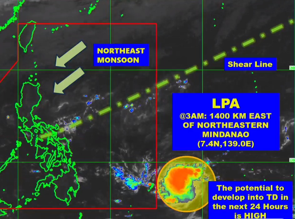
The Philippine Atmospheric Geophysical and Astronomical Services Administration in Mactan (Pagasa-Mactan) said the weather disturbance has a high chance of becoming a tropical depression in the next 24 hours.
Jhomer Eclarino, weather specialist at Pagasa-Mactan, said should the LPA strengthen into a tropical depression, it will be named ‘Kabayan.’
READ MORE: LPA monitored by Pagasa-Mactan, hot weather still prevails in Cebu
“And then it will be the 11th storm for the year,” said Eclarino in Cebuano.
Once the LPA becomes a tropical depression, Pagasa will then release its projected track and possible landfall scenarios, he added.
“We’re already preparing models should the LPA become a tropical cyclone (depression),” Eclarino explained.

As of 3 a.m. on Monday, the LPA was spotted 1,400 kilometers northeast of Mindanao.
It is forecasted to enter the Philippine Area of Responsibility (PAR) between Wednesday, November 15, and Thursday, November 16.
READ MORE: Metro Cebu: Rainy weather expected as LPA monitored by Pagasa-Mactan
In the meantime, Cebu will continue to experience hot and humid weather in the next few days.
Pagasa-Mactan has also advised the public to regularly monitor weather updates.
/bmjo