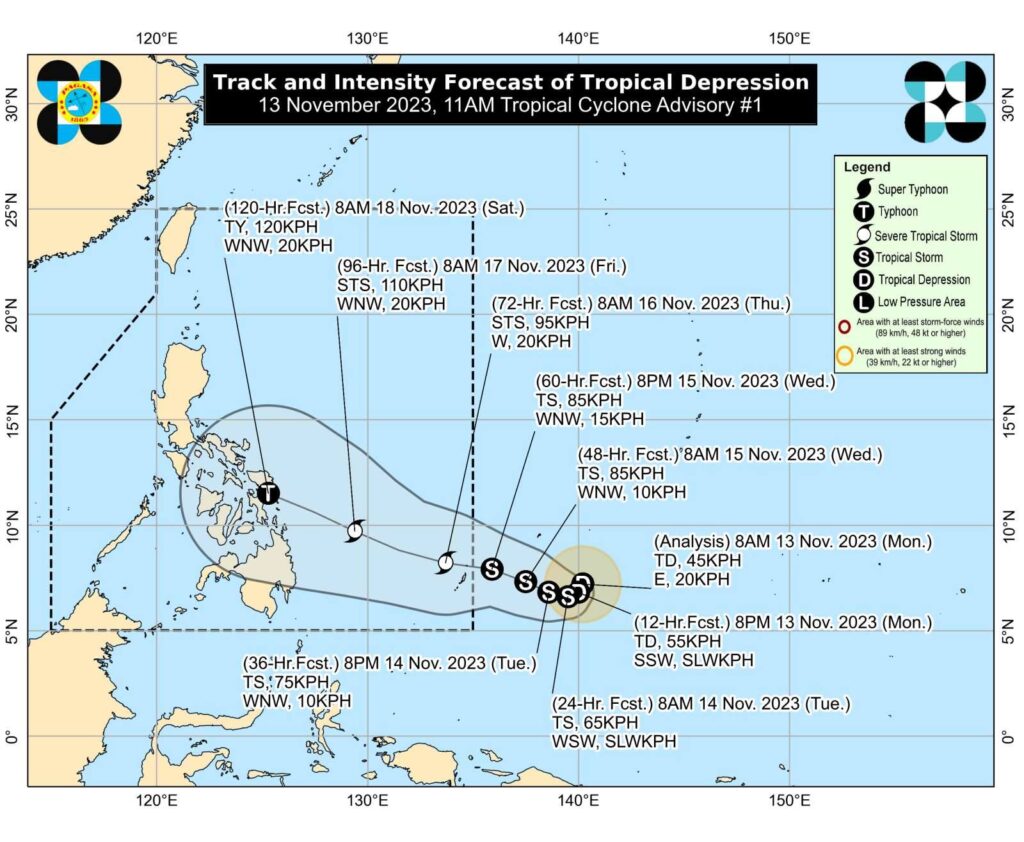
Forecast track of Tropical Depression Kabayan as of November 13, 2023. | Photo courtesy of Pagasa
CEBU CITY, Philippines – The low-pressure area (LPA) east of Mindanao has become a tropical depression, and may intensify into a typhoon before it will bring heavy rains over the Visayas and Mindanao regions, the state weather bureau said.
The Philippine Atmospheric Geophysical and Astronomical Services Administration (Pagasa) announced on Monday, November 13, 2023, that the LPA spotted 1,540 kilometers east of Mindanao has become a tropical depression.
It will be named ‘Kabayan’ once it enters the Philippine Area of Responsibility (PAR) between late Wednesday evening, November 15, and Thursday, November 16.
In its weather bulletin issued at 11 a.m. on Monday, Pagasa stated that the tropical depression may also further intensify before reaching land, and may become a typhoon on Saturday, November 18.
“This tropical cyclone may intensify over the TCA (tropical cyclone advisory) region and reach Typhoon category with a peak intensity of 120 kilometers per hour (kph) on Saturday. The possibility of further intensification prior to its close approach to Eastern Visayas is not ruled out,” they said.
With its presence, state meteorologists predicted that heavy rainfall in several provinces in Visayas, Mindanao, and Bicol is expected, starting this Friday, November 17.
Based on Pagasa’s forecast models, ‘Kabayan’ may make landfall in the vicinity of Pinanag-an in Eastern Samar on Saturday.
Meanwhile, Kabayan presently packs wind with speeds of 45 kph and gustiness of 55 kph. It is moving in an eastward direction at a speed of 20 kph.
Pagasa reminds the public to regularly monitor weather updates.
RELATED STORIES
LPA monitored by Pagasa-Mactan, hot weather still prevails in Cebu
LPA east of Mindanao has ‘high chance’ of developing into tropical depression