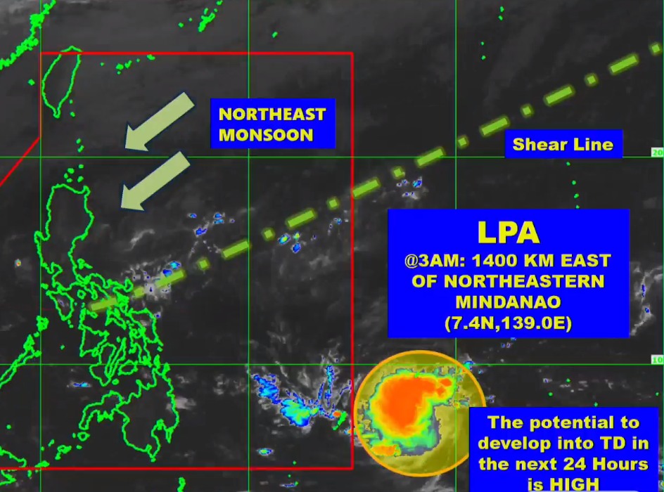
LPA east of Mindanao has ‘high chance’ of developing into tropical depression

Photo courtesy of Pagasa-Visayas
CEBU CITY, Philippines – Chances are high for the low-pressure area (LPA) spotted east of Mindanao to develop into a tropical depression soon, the state weather bureau said.
The Philippine Atmospheric Geophysical and Astronomical Services Administration in Mactan (Pagasa-Mactan) said the weather disturbance has a high chance of becoming a tropical depression in the next 24 hours.
Jhomer Eclarino, weather specialist at Pagasa-Mactan, said should the LPA strengthen into a tropical depression, it will be named ‘Kabayan.’
READ MORE: LPA monitored by Pagasa-Mactan, hot weather still prevails in Cebu
“And then it will be the 11th storm for the year,” said Eclarino in Cebuano.
Once the LPA becomes a tropical depression, Pagasa will then release its projected track and possible landfall scenarios, he added.
“We’re already preparing models should the LPA become a tropical cyclone (depression),” Eclarino explained.
As of 3 a.m. on Monday, the LPA was spotted 1,400 kilometers northeast of Mindanao.
It is forecasted to enter the Philippine Area of Responsibility (PAR) between Wednesday, November 15, and Thursday, November 16.
READ MORE: Metro Cebu: Rainy weather expected as LPA monitored by Pagasa-Mactan
In the meantime, Cebu will continue to experience hot and humid weather in the next few days.
Pagasa-Mactan has also advised the public to regularly monitor weather updates.
/bmjo
Disclaimer: The comments uploaded on this site do not necessarily represent or reflect the views of management and owner of Cebudailynews. We reserve the right to exclude comments that we deem to be inconsistent with our editorial standards.
