


Image from the Philippine Atmospheric, Geophysical, and Astronomical Services Administration
MANILA, Philippines — The state weather bureau said that rains would be expected on most parts of the country on Monday, October 21, due to the trough of a low-pressure area (LPA).
Cloudy skies with scattered rains and thunderstorms due to the trough of the LPA would be experienced in areas in Southern Luzon, Bicol Region, Eastern Visayas, and Mindanao, said the Philippine Atmospheric Geophysical Astronomical Services Administration (Pagsa) on their October 20 afternoon forecast.
“This trough is bringing cloudy skies with scattered rainshowers and thunderstorms over Aurora, Quezon, the Bicol Region, Northern Samar, Palawan, the Zamboanga Peninsula, BARMM, and SOCCSKSARGEN,” state weather specialist Veronica Torres said.
READ MORE:
EXPLAINER: What do color-coded rainfall warnings mean?

Meanwhile, partly cloudy to cloudy skies with isolated rainshowers or thunderstorms are expected in Metro Manila and the rest of the country.
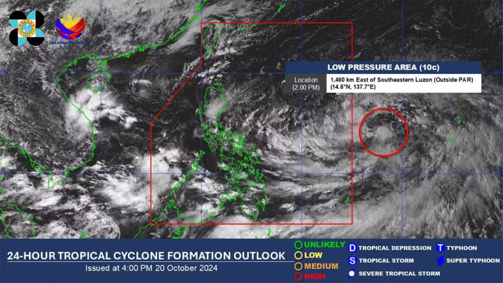
According to Pagasa, the LPA outside the Philippine Area of Responsibility may develop into a tropical depression in the next 24 hours, while it is forecast to enter the country by Sunday or Monday.
As of 3 p.m. the LPA was spotted 1,450 kilometers east of southeastern Luzon.
No gale warning was hoisted by Pagasa over any of the country’s seaboards.