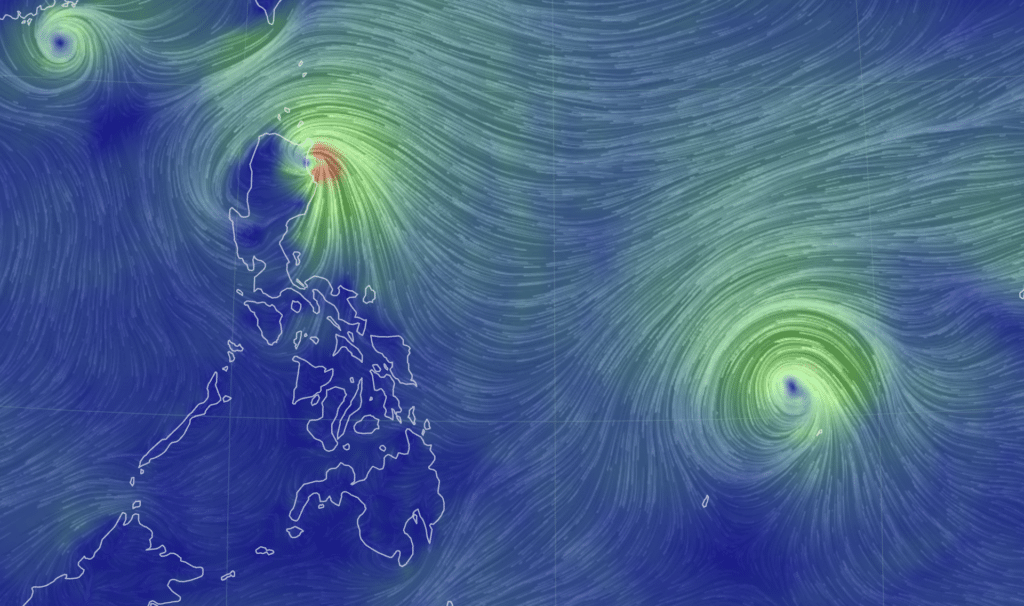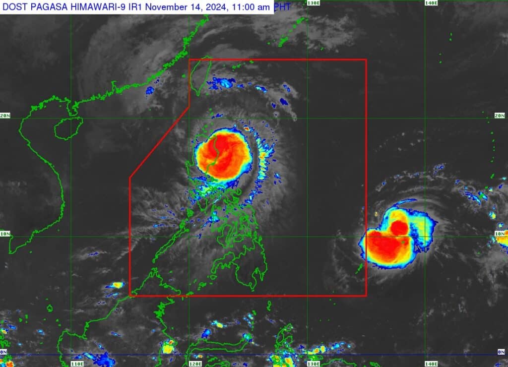
Screenshot from Earth Nullschool
CEBU CITY, Philippines — Residents in the Visayas region are advised to regularly monitor weather updates as Tropical Storm Man-yi (Pepito) makes its way towards the Philippines.
Man-yi is expected to enter the Philippine Area of Responsibility on Thursday evening, November 14, the state weather bureau said.
It will then be assigned the local name Pepito.
However, latest forecast models from the Philippine Atmospheric Geophysical and Astronomical Services Administration (Pagasa) showed that the storm may likely bring damp weather in the Visayas, particularly in the Eastern and Samar side.
As a result, Cebu may also experience light to moderate rains beginning this weekend, said Romeo Aguirre, weather specialist at Pagasa-Mactan.
READ MORE
‘Man-yi’ may enter PAR as ‘Pepito’ Thursday night
Ofel, fifth storm in under a month, bears down on PH
“Latest forecast nagkaubos gyud siya. Ang general movement niya is south-southwest movement. Kung magpadayun ni siya, most likely mudikit sa Eastern Samar and Samar by Saturday,” Aguirre said.
(Latest forecast, it has weakened. Its general movement is a south-southwest movement. If this continues, most likely, this will stick to Easterm Samar and Samar by Saturday.)
Should this scenario prevail, Pagasa-Mactan also said tropical cyclone wind signal (TCWS) would possibly be raised over areas in northern Cebu as well as in Metro Cebu.
However, Aguirre clarified that state meteorologists were still facing forecast uncertainty over Man-Yi and their projections might change.
“Every six hours, mag issue man to ug weather bulletin, nakabantay mi nga daghan gyud siya (Man-Yi) og kausaban.” he explained.
(Every six hours, we issue a weather bulletin, we noticed that it has a lot of changes.)
In turn, they urged the public to regularly monitor weather update.
“Continuous weather monitoring lang ta. Wa may mawala if mangandam gyud ta. Ang precautionary measures, ato lang gyung buhaton,” said Aguirre.
(We will just do continuous weather monitoring. We will not lose anything if we just prepare. The precautionary measures, we’ll just do that.)
In its 11 a.m. bulletin on Thursday, Pagasa said Man-yi is estimated at 1,375 kilometers east of northeastern Mindanao.
As of 10 a.m., Man-yi packs maximum sustained winds of 85 kilometers per hour (kph) near the center, with gustiness of up to 105 kph.
The storm is moving west southwestward at a speed of 25 kph.
On the track forecast, Pagasa said Man-yi might make landfall over the eastern coast of Southern Luzon during the weekend (November 16 or 17).
In addition, the state weather bureau forecasted the storm to intensify into a severe tropical storm on Thursday and may reach typhoon category by Friday morning. / with reports from INQUIRER.net
