‘Man-yi’ may enter PAR as ‘Pepito’ Thursday night

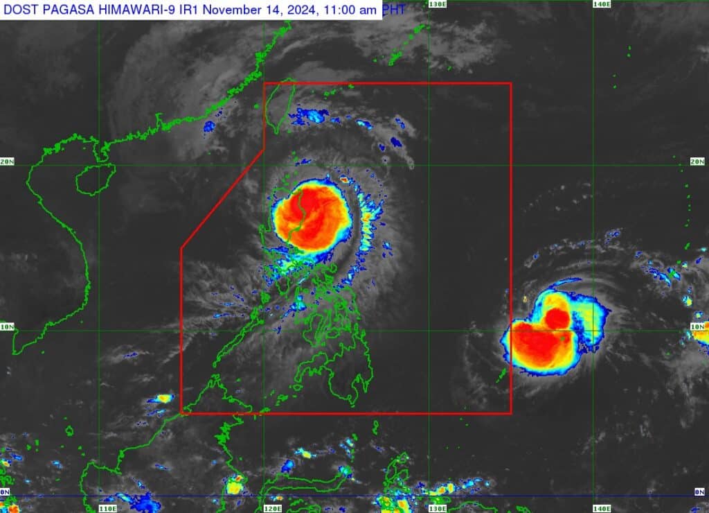
A look at topical storm Man-yi, which is nearing the PAR. It will be called ‘Pepito’ once it enters the PAR. | Pagasa
As super typhoon Ofel makes its way to northern Luzon, Tropical Storm ‘MAN-YI’ is expected to enter the Philippine Area of Responsibility (PAR) on Thursday night, Pagasa said.
In its 11 a.m. bulletin on Thursday, Pagasa said Man-yi, which will be named Pepito when in enters PAR, is estimated at 1,375 kilometers east of northeastern Mindanao.
READ MORE:
Ofel is now a super typhoon; Signal no. 5 raised in northeastern Cagayan
Pagasa said Man-yi may enter the PAR region Thursday evening.
As of 10 a.m., Man-yi packs maximum sustained winds of 85 km/h near the center, gustiness of up to 105 km/h, and central pressure of 996 hPa.
It is moving west southwestward at 25 km/h.
“Due to the high pressure area over the south of Japan, MAN-YI is forecast to move southwestward over the next 12 hours before turning generally westward while approaching the eastern boundary of the Philippine Area of Responsibility (PAR),” Pagasa said in its bulletin.
On the track forecast, Pagasa said Pepito may make landfall over the eastern coast of Southern Luzon during the weekend (November 16 or 17).
Pepito may become super typhoon
Pagasa also said Man-yi is forecast to intensify into a severe tropical storm on Thursday and may reach typhoon category by Friday morning.
“The possibility of rapid intensification is not ruled out. Since this tropical cyclone may reach typhoon category while over the Philippine Sea, the possibility for Man-yi to reach super typhoon category prior to landfall is also not ruled out,” Pagasa said.
Disclaimer: The comments uploaded on this site do not necessarily represent or reflect the views of management and owner of Cebudailynews. We reserve the right to exclude comments that we deem to be inconsistent with our editorial standards.
