Cebu braces for rain showers as LPA threat looms
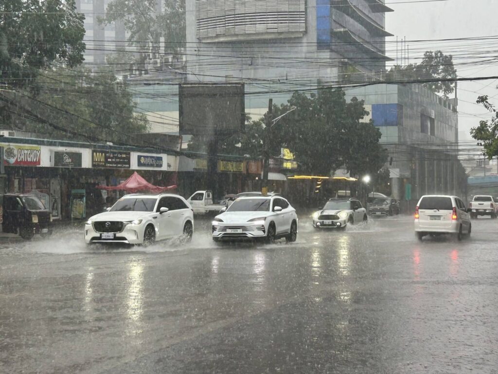
CEBU CITY, Philippines — Metro Cebu and the rest of the province are set for a wet weekend as partly cloudy skies give way to isolated rain showers and thunderstorms.
The state weather bureau urges residents to stay alert amid warnings of a potential low-pressure area forming in Philippine waters.
According to the Philippine Atmospheric, Geophysical and Astronomical Services Administration (Pagasa) Visayas office, the province will experience partly cloudy to occasionally cloudy skies with isolated rain showers or thunderstorms on Saturday, November 22.
Temperatures will range from 25 to 32 degrees Celsius, accompanied by light to moderate northeast winds and slight to moderate coastal conditions.
READ: LPA ‘highly likely’ to form in PAR, may affect PH by Sunday
Wet weather expected to persist
The weather pattern is expected to persist through the week. Sunday, November 23, will see similar conditions, with temperatures slightly cooler at 25 to 30 degrees Celsius.
By Monday, November 24, the thermometer is projected to stay between 24 and 30 degrees Celsius with moderate northeast winds and moderate coastal waves. Conditions will remain variable through November 26, when winds shift slightly from southeast to east and coastal waters remain slight to moderate.
Pagasa noted that the broader weather scenario is influenced by a combination of a shear line affecting Northern Luzon, the northeast monsoon over the northern areas, and the Intertropical Convergence Zone impacting Mindanao and Palawan.
Meanwhile, the Visayas, including Cebu, and Occidental Mindoro will continue to experience partly cloudy to cloudy skies with isolated rain showers or thunderstorms due to easterlies.
Moderate to strong northeast winds with moderate to rough seas are expected across the Visayas and Palawan, including the Kalayaan Islands.
READ: Rainy Saturday in most of PH due to 4 weather systems
LPA threat looms
Adding to concerns, Pagasa has flagged a tropical cyclone-like vortex (TCLV) in the southeastern part of the Philippine area of responsibility (PAR) as “highly likely” to develop into a low-pressure area by Sunday, November 23.
Specialist John Manalo said the system could affect northeastern Mindanao and Eastern Visayas first, with its impact most strongly felt starting Monday.
“If the TCLV develops into a tropical cyclone within the PAR, it will be named Verbena,” Manalo explained.
He added that the system could traverse the country and emerge over the West Philippine Sea between November 28 and December 4. During that time, a second TCLV may form in the eastern monitoring domain, though it has a low chance of intensifying into a tropical cyclone.
Pagasa advises residents to monitor weather updates, secure loose outdoor items, and exercise caution near coastal and flood-prone areas as the potential low-pressure area approaches./ with reports from Inquirer.net
Disclaimer: The comments uploaded on this site do not necessarily represent or reflect the views of management and owner of Cebudailynews. We reserve the right to exclude comments that we deem to be inconsistent with our editorial standards.