Storm surge hazard map for CV ready by yearend

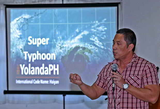
ADAPT AND OVERCOME. Alfredo Quiblat, Jr. acting chief of Pagasa-Mactan explains the need to mitigate the impact of extreme weather like supertyphoon Yolanda before participants of the Mainstreaming Disaster Risk Reduction and Climate Change Adaptation at the USPF conference room.
The Philippine Atmospheric, Geophysical and Astronomical Services (Pagasa) is completing a storm surge hazard mapping of Central Visayas.
The new hazard map will be available before the end of the year.
The exercise aims to determine the vulnerability of certain areas in Cebu, Bohol, Siquijor and Negros Oriental to storm surges.
Once the mapping is accomplished, the state weather bureau will integrate storm surge warnings in the weather bulletins it regularly issues.
Alfredo Quiblat Jr., acting chief meteorological officer of Pagasa-Mactan said that they need to conduct surveys and evaluations because not all areas are prone to storm surges.
“We can immediately track areas prone to storm surge if we already have the hazard map,” he said.
Current geohazard maps generated by the Department of Environment and Natural Resources only indicate areas prone to floods and landslides.
The survey started earlier this year and will be completed before the year will end, Quiblat said.
“We learned a lesson after we experienced supertyphoon Yolanda (Haiyan) especially along the coastal areas,” he said.
Limitations
He also admits that as of today, Pagasa does not possess the equipment to monitor storm surges but they have radar and satellites to monitor incoming and possible typhoons.
Marine Weather Station equipment had been installed in Madridejos, north Cebu but these were damaged by supertyphoon Yolanda last November 8.
The equipment, however, can only keep track of the height of the waves and temperature but not storm surges.
Quiblat further explained that with storms preceding supertyphoon Yolanda, Pagasa had issued warnings of possible storm surges but people specially those living along the storm’s path either did not understand or simply ignored the warnings.
“It was not clear before. But when we experienced Yolanda, then we already realized what storm surge was,” he added.
Less typhoons
Meanwhile, Quiblat said that Pagasa forecasts a decrease in the number of typhoons this year. The country was lashed by 25 typhoons last year, including ‘what ’Yolanda” which is now considered to be the strongest to hit land in recorded history.
A storm surge is an offshore rise of water associated with a low pressure weather system, typically tropical typhoons and strong extratropical cyclones. Storm surges are caused primarily by high winds pushing on the ocean’s surface. The wind causes the water to pile up higher than the ordinary sea level.
Disclaimer: The comments uploaded on this site do not necessarily represent or reflect the views of management and owner of Cebudailynews. We reserve the right to exclude comments that we deem to be inconsistent with our editorial standards.
