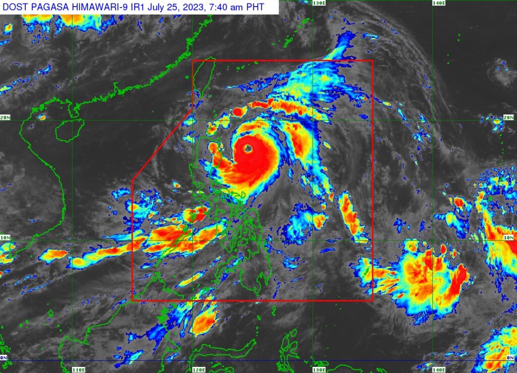
Super Typhoon Egay (international name: Doksuri) as of Tuesday, July 25, 2023. | Photo from Pagasa
CEBU CITY, Philippines – Storm Signal No. 1 may have been lifted in northern Cebu but the island province will continue to experience cloudy skies and windy weather as Super Typhoon Egay (international name: Doksuri) brings a stronger habagat or southwest monsoon.
In its latest severe weather bulletin on Tuesday, July 25, the Philippine Atmospheric Geophysical and Astronomical Services Administration (Pagasa) removed northern Cebu from the list of areas covered under Tropical Cyclone Wind Signal (TCWS) No. 1 due to Egay.
But damp weather is still expected in Cebu despite the lifting of storm signals.
According to the state weather bureau, the entire Visayas will experience cloudy skies with scattered rainshowers and thunderstorms due to the prevailing habagat that has been intensified by the presence of Egay.
“Strong winds from the southwest will prevail over Visayas, Palawan including Kalayaan Islands and Occidental Mindoro with rough seas,” Pagasa forecasted.
To recall, Pagasa placed northern Cebu under TCWS No. 1 last Monday, July 24 due to the presence of Egay, which was still a typhoon back then.
Egay developed into the super typhoon category on Tuesday morning with four areas now under Tropical Cyclone Wind Signal No. 3, state meteorologists said.
The super typhoon is located 310 kilometers east of Tuguegarao City, Cagayan, packing maximum sustained winds of 185 kph near the center and gustiness of up to 230 kph, according to the Philippine Atmospheric, Geophysical and Astronomical Services Administration (Pagasa) said in its latest update.
“Egay is nearing its peak intensity,” Pagasa also said.
Pagasa has also placed several areas under Tropical Cyclone Wind Signal (TCWS) No. 3, where winds greater than 89 kilometers per hour (kph) to up to 117 kph is expected in at least 18 hours. / with reports from INQUIRER.net
RELATED STORIES
Egay now a super typhoon – Pagasa
Signal No. 1 in northern Cebu: 51 passengers stranded with suspension of sea trips
Typhoon Egay: Northern portions of Cebu under Signal no. 1

