Typhoon Goring maintains strength; Signal No. 1 in 3 areas — Pagasa
MANILA, Philippines — Typhoon Goring (international name: Saola) maintained its strength while moving north over the Philippine Sea, while parts of three northern provinces are under tropical cyclone wind signal number 1, according to the Philippine Atmospheric, Geophysical, and Astronomical Services Administration (Pagasa).
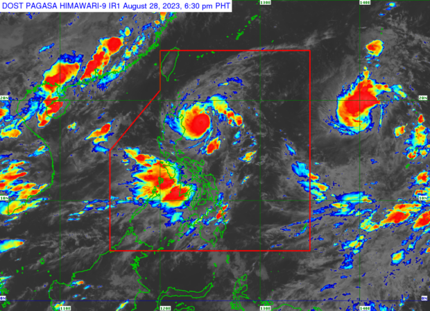
In its Monday afternoon update, Pagasa reported that Goring was spotted some 260 kilometers (km) east of Tuguegarao City, with a maximum wind speed of 155 kilometers per hour (kph) near the center and gusts of up to 190 kph.
Pagasa weather specialist Aldczar Aurelio said that there is a possibility that Goring may make landfall in Batanes between Wednesday evening and Thursday morning.
“Inaasahan nating lalabas ng Philippine area of responsibility [ang Bagyong Goring] sa araw ng Thursday ng umaga o hapon,” said Aurelio.
(We expect [Typhoon Goring] to leave the Philippine area of responsibility on Thursday morning or afternoon.)
Areas under Signal No. 1
- Batanes;
- The northern and eastern portion of mainland Cagayan (Camalaniugan, Pamplona, Gonzaga, Santa Teresita, Baggao, Buguey, Santa Ana, Claveria, Aparri, Ballesteros, Abulug, Sanchez-Mira, Santa Praxedes, Allacapan, Lal-Lo, Lasam, Peñablanca, Iguig, Amulung, Gattaran, Alcala) including Babuyan Island;
- The eastern portion of Isabela (Dinapigue, San Mariano, Ilagan City, Tumauini, San Pablo, Cabagan, Maconacon, Divilacan, Palanan)
‘Habagat’ alert
Aurelio added that the effects of the southwest monsoon or “habagat” will continue to affect most parts of the country until Tuesday.
“Patuloy pa rin na hinahatak ni Goring ang habagat kaya ang habagat ay patuloy na makakaapekto sa ating bansa,” Aurelio pointed out.
(Goring is still enhancing the habagat which will continue to affect the country.)
Rainfall warning
Heavy rainfall warning (50 to 100 millimeters (mm) of rain) was issued for Zambales, Bataan, Cavite, Batangas, the northern portion of Palawan including Calamian and Cuyo Islands, Antique, southwestern portion of Iloilo, and northwestern, portion of Aklan.
On the other hand, 100 to 200 mm of rain is forecast in Occidental Mindoro.
RELATED STORIES
Goring weakens to typhoon; may become super typhoon anew on Tuesday
Goring now a super typhoon, storm signals up over 19 areas in Luzon — Pagasa
Typhoon Goring ‘rapidly intensifies’; parts of Cagayan, Isabela under Signal No. 2
Disclaimer: The comments uploaded on this site do not necessarily represent or reflect the views of management and owner of Cebudailynews. We reserve the right to exclude comments that we deem to be inconsistent with our editorial standards.