


MANILA, Philippines—Flash floods and landslides are possible across the Philippines due to the southwesterly windflow and other weather disturbances, especially in the western sections of Southern Luzon, Visayas, and Mindanao, the state weather bureau said on Saturday.
In its 4 p.m. forecast, the Philippine Atmospheric, Geophysical and Astronomical Services Administration (Pagasa) warned Palawan, Visayas, Zamboanga Peninsula, Northern Mindanao, and Caraga to prepare for potential flooding and landslides due to “moderate to at times heavy rains” triggered by two weather systems: southwesterly windflow and the trough of Super Typhoon Betty.
Metro Manila and the rest of the country could experience similar conditions in the next 24 hours, including possible flooding and landslides during severe thunderstorms triggered by the southwesterly windflow and localized thunderstorms.
Betty’s status
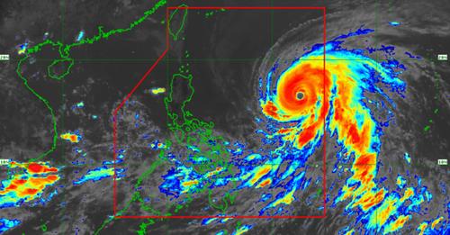
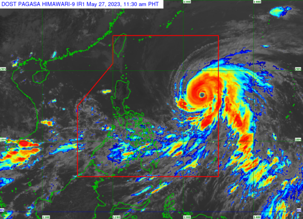
Typhoon Betty continues to move westward at a speed of 25 kilometers per hour and was located 1,055 km east of Central Luzon as of 3 p.m. Saturday.
Betty is projected to maintain its super typhoon status over the weekend, with potential short-term intensification in the next 12-24 hours.
The weather bureau anticipates the tropical cyclone may significantly weaken on Monday or Tuesday as it decelerates over waters east of Batanes.
As of 5 p.m., Pagasa has also issued a gale warning over the northern and eastern seaboards of Luzon, and the eastern seaboards of Visayas and Mindanao due to strong winds associated with Typhoon Betty.
RELATED STORIES
CPA readies for impact of Super Typhoon Mawar
Super Typhoon Mawar even stronger as it roars closer to PAR border
2 sea trips in Cebu City, Calbayog City temporarily suspended for maintenance, Mawar
Way klase: Cebu localities suspend classes as Mawar looms