

Image from DOST / Pagasa
MANILA, Philippines — Tropical Storm Khanun will enter the Philippine area of responsibility (PAR) on Saturday morning, state meteorologists said.
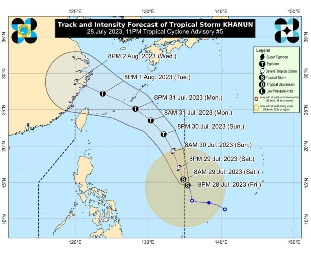
Khanun was last located 1,245 kilometers east northeast of southeastern Luzon, packing maximum sustained winds of 65 kilometers per hour (kph) with gustiness of 80 kph, according to the Philippine Atmospheric, Geophysical and Astronomical Services Administration’s (Pagasa) Friday bulletin.
“Khanun is forecast to enter the Philippine area of responsibility in the next 12 hours,” the Pagasa said in its 11 p.m. advisory.
Once inside PAR, the tropical storm will be called Falcon.
The tropical storm, however, is forecast to remain far from the Philippine landmass before going out of PAR by Monday.
“The tropical storm is forecast to move generally north northwestward or northwestward during its passage within the PAR region,” Pagasa said.
“On the forecast track, the storm is forecast to remain far from the Philippine landmass and may exit the PAR on Monday.”
RELATED STORIES
Tropical storm Khanun maintains strength, still outside PAR
New LPA may enter PAR July 29 and develop into tropical depression – Pagasa
Storm Signal No. 1 lifted in northern Cebu but windy weather prevails