Sea trips to Luzon, parts of the Visayas suspended due to Typhoon Rolly

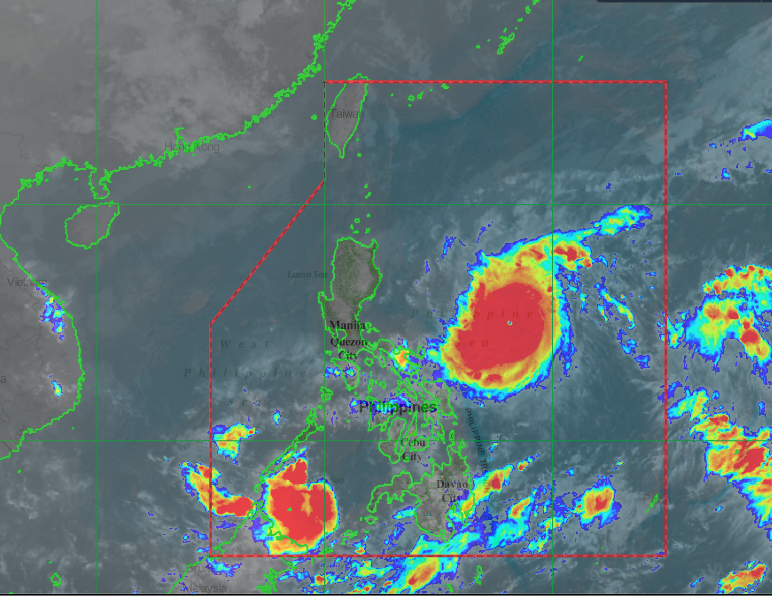
Typhoon Rolly | PAGASA HIMAWARI SATELLITE I
CEBU CITY, Philippines – The Philippine Coast Guard in Cebu (PCG-Cebu) has ordered the suspension of sea travels from the island province to Luzon and parts of the Visayas that will be affected by Typhoon Rolly (international name: Goni).
In a notice issued on Saturday, October 31, Acting Commander Alvin Dagalea said that the order will take effect immediately and until further notice.
“Due to the Tropical Cyclone Warning Signal (TCWS) No. 1, 2, 3 hoisted in Luzon and Visayas brought by Typhoon Rolly, Coast Guard Station Central Cebu is now enforcing temporary suspension of voyages for all types of vessels or watercraft as proactive measures in order to avert maritime accidents,” reads a portion of the memorandum.
RELATED STORY: Typhoon ‘Rolly’ to be closest to Central Luzon, Metro Manila on Sunday night — Pagasa
Trips to and passing through Catanduanes will not be allowed since it was placed under Storm Signal No. 3 by the state weather bureau, as well as those in Camarines Norte, Camarines Sur, Albay, Sorsogon, Burias and Ticao Islands, and the southeastern portion of Quezon province, including Polillo Islands, that are now under Storm Signal No. 2.
PCG-Cebu’s recent order also covers voyages that are bound for Masbate, Cavite, Batangas, Marinduque, Romblon, Occidental, and Oriental Mindoro, Metro Manila, Pampanga, Bataan, Zambales, Aurora, Pangasinan, La Union, Northern Samar, Eastern Samar, and Biliran.
As of 11 a.m., the Philippine Atmospheric Geophysical and Astronomical Services Administration (Pagasa) has also hoisted Storm Signal No. 1 over Tarlac, Nueva Ecija, Aurora, Pangasinan, La Union, Benguet, Ifugao, Nueva Vizcaya, Quirino, and the southern portion of Isabela.
“Voyage of vessels will resume upon [the] improvement of weather and sea condition in these areas,” Dagalea said.
“Vessels who intend to take shelter shall be permitted as long as it is manifested through [a] written request and no passenger shall be allowed on board,” he added.
Typhoon Rolly, which several weather experts abroad tagged as the world’s strongest major weather disturbance that formed this year, was spotted 480 kilometers East Northeast of Virac, Catanduanes, according to the latest severe weather bulletin issued by the Pagasa.
READ MORE: ‘Rolly’ nearing super typhoon category, seen growing more powerful
It has wind of up to 215 kilometers per hour with gustiness reaching up to 265 kilometers per hour.
Under Pagasa’s tropical cyclone category, storms with winds above 220 kilometers per hour are considered supertyphoons.
Pagasa forecasted Rolly to make landfall on Aurora and northern Quezon areas on Sunday, November 1.
“On the forecast track, the center of the eye of the typhoon is forecast to pass very close to Catanduanes, the Calaguas Islands, and very close to mainland Camarines Provinces tomorrow morning, and over Polillo Islands and mainland Quezon tomorrow afternoon,” said Pagasa.
“However, due to the proximity of the forecast track to Bicol Region, a landfall scenario over Catanduanes and Camarines Provinces is not ruled out,” they added. / dcb
Disclaimer: The comments uploaded on this site do not necessarily represent or reflect the views of management and owner of Cebudailynews. We reserve the right to exclude comments that we deem to be inconsistent with our editorial standards.
