‘Kiko’ may intensify into supertyphoon as ‘Jolina’ moves to exit PAR
DOST Pagasa photo
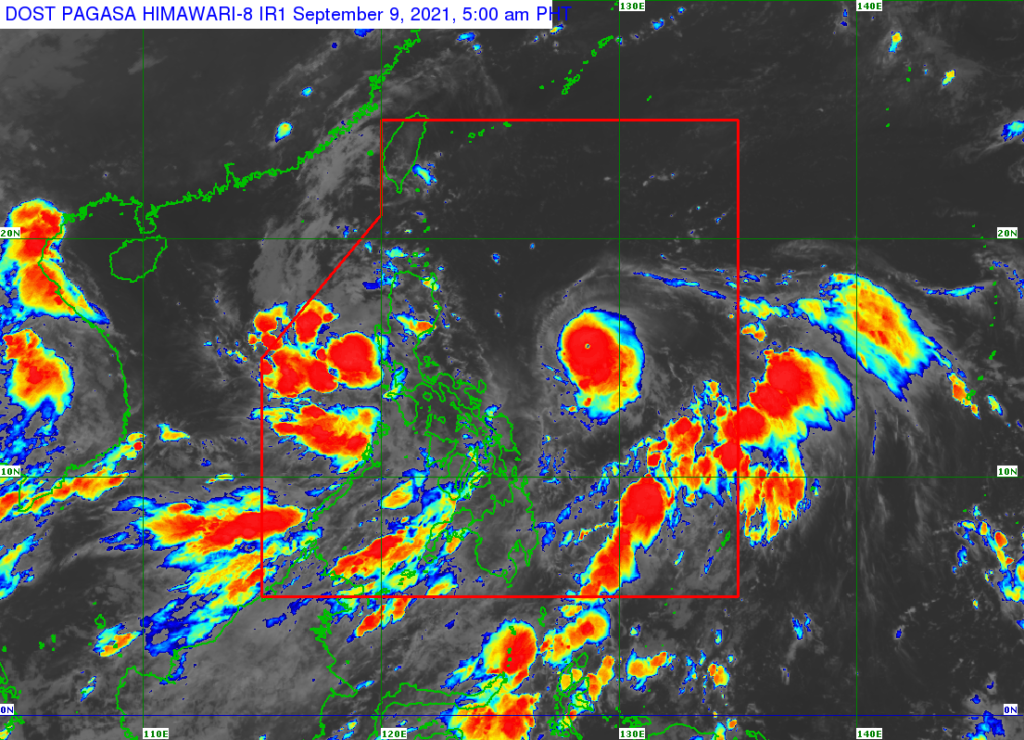
MANILA, Philippines — Tropical Storm Jolina (Conson) continued to move away from the country early Thursday, September 9, 2021, but the state weather agency is also closely watching the movement of Typhoon Kiko (Chanthu), which could turn into a super typhoon in the coming days.
Weather specialist Benison Estareja of the Philippine Atmospheric Geophysical Astronomical Services Administration said Kiko will reach its peak intensity of 205 kilometers per hour on Friday while crossing Babuyan Islands.
“We have to take note na possible siya maging isang super typhoon dahil yung 205 kph habang andito malapit sa super typhoon na category threshold na 225 km/hr,” he said.
(We have to take note that it’s possible to turn into a super typhoon because the 205 km/hr peak intensity is close to the super typhoon category threshold of 225 km/hr).
Signal No. 1 is currently raised over the eastern portion of Cagayan (Buguey, Lal-Lo, Santa Teresita, Gonzaga, Santa Ana, Gattaran, Baggao, Peñablanca) and the northeastern portion of Isabela (Maconacon, Divilacan, San Pablo, Cabagan, Palanan).
Esteraja said they have not ruled out the possibility that Kiko would make landfall over mainland Cagayan.
Starting Friday evening, heavy to intense with at times torrential rains due to the Kiko may be experienced over Cagayan including Babuyan Islands, and northern Isabela. Storm signals are expected to go higher.
Moderate to heavy with at times intense rains may also be experienced over Batanes and the rest of Isabela, Pagasa said.
Scattered to widespread flooding (including flash floods) and rain-induced landslides are likely.
Kiko was last spotted 785 kilometers east of Baler, Aurora, packing maximum sustained winds of 185 km/h near the center and gusts of up to 230 km/h. It was moving westward at 20 km/h.
The typhoon was forecast to pass close to northeastern Cagayan, cross Babuyan Islands and pass near Batanes from Friday afternoon to Saturday afternoon.
Kiko may exit the Philippine area of responsibility and start to weaken on Sunday, while in the west coast of Taiwan.
Meanwhile, Tropical Storm Jolina, which was last spotted 175 kilometers west of Dagupan City, Pangasinan or over the West Philippine Sea, continued to move away from the landmass of Luzon.
Signal No. 1 was raised over the western portion of Pangasinan (Anda, Bolinao, Infanta, Aguilar, Sual, Labrador, Dasol, Bugallon, Burgos, Mabini, Agno, City of Alaminos, Bani, Lingayen, Mangatarem) and the northern portion of Zambales (San Antonio, Botolan, San Narciso, San Felipe, Cabangan, Palauig, Iba, Masinloc, Candelaria, Santa Cruz). This may be soon lifted as Jolina continued to move away from the country.
Disclaimer: The comments uploaded on this site do not necessarily represent or reflect the views of management and owner of Cebudailynews. We reserve the right to exclude comments that we deem to be inconsistent with our editorial standards.