Pagasa: Jenny now a typhoon
Most of PH to experience rain
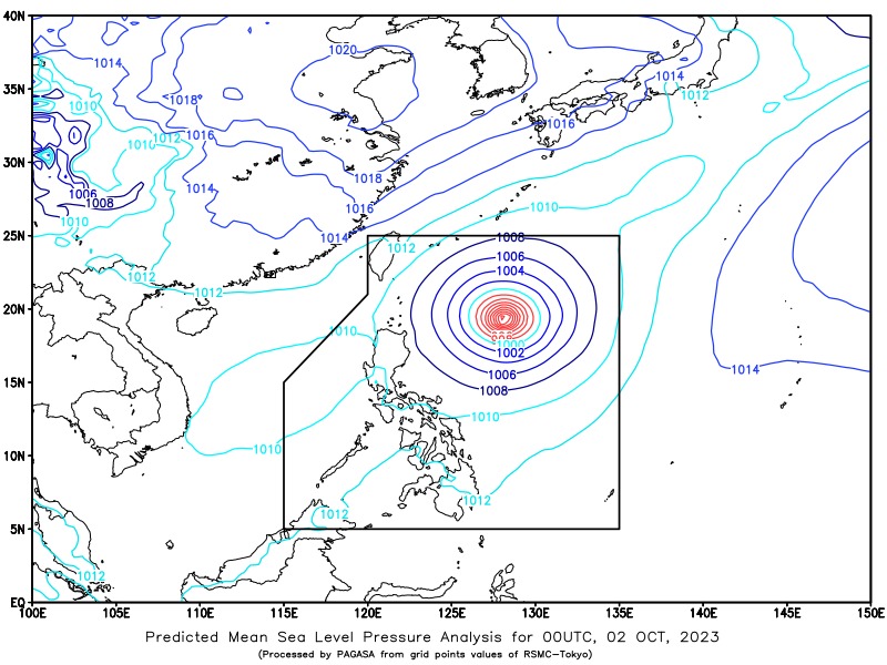
Pagasa image
MANILA, Philippines — Jenny is now a typhoon, according to the latest bulletin of the Philippine Atmospheric, Geophysical, and Astronomical Services Administration (Pagasa).
Typhoon Jenny, which has an international name Koinu, was located 675 kilometers (km) east of Aparri, Cagayan as of 3 a.m. on Monday, October 2, 2023.
Jenny packs maximum sustained winds of 120 kilometers per hour (kph) near the center and gustiness of up to 150 kph. It was moving northwestward at a speed of 10kph.
“Mamayang hapon ay inaasahan natin na nasa 580 km silangan na ng Calayan, Cagayan [ang sentro ng mata ng bagyo], habang bukas ay nasa 240 km silangan ng Basco, Batanes, at 330 km silangan ng Ibtayat, Batanes hapon ng Martes,” said Pagasa weather specialist Obet Badrina.
(By late afternoon we expect it [the center of the typhoon’s eye] to be 580 km east of Calayan, Cagayan, while tomorrow it will be 240 km east of Basco, Batanes, and 330 km east of Ibtayat, Batanes by Tuesday afternoon.)
He added that Jenny will unlikely hit the landmass of Batanes unless it moves southward.
“Ang nakikita natin sa araw ng Huwebes ay tatama ang mata ng bagyong si Jenny sa southern part ng Taiwan,” he continued.
(What we see on Thursday is that the eye of typhoon Jenny will hit the southern part of Taiwan.)
Badrina said Jenny is expected to leave the Philippine area of responsibility by Friday, October 6.
JennyPH: Signal no. 1
Meanwhile, Pagasa maintained Tropical Cyclone Wind Signal No. 1 over Batanes, Babuyan Islands, the eastern portion of mainland Cagayan (Sta. Ana, Gonzaga, Buguey, Sta. Teresita, Lal-Lo, Baggao, Gattaran, Peñablanca), and the eastern portion of Isabela (Maconacon, Divilacan, and Palacan).
Gale warnings likewise remain over the seaboards of Batanes and Babuyan Islands.
As for other parts of the country, Badrina said the southwest monsoon, locally known as habagat, will continue to bring cloudy skies with scattered rain showers and thunderstorms over Visayas, Zamboanga Peninsula, and Mimaropa (Mindoro Oriental and Occidental, Marinduque, Romblon, and Palawan).
He also said that partly cloudy to cloudy skies with isolated rain showers or thunderstorms will be experienced in Metro Manila and the rest of the country brought by the trough or extension of Jenny and localized thunderstorms.
Pagasa warned of possible flash floods or landslides in these areas during severe thunderstorms.
READ MORE:
Severe Tropical Storm Jenny intensifies; Signal No. 1 in Batanes
Disclaimer: The comments uploaded on this site do not necessarily represent or reflect the views of management and owner of Cebudailynews. We reserve the right to exclude comments that we deem to be inconsistent with our editorial standards.