


‘Ruby’ crawls across PH; Flood-causing rains noted
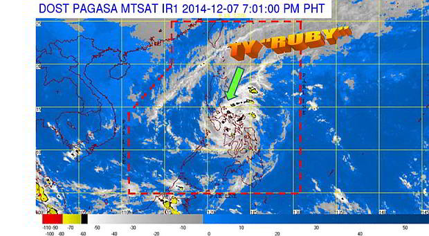 Typhoon “Ruby” (international name: Hagupit) continues to crawl across the central Philippine islands at 10 kilometers per hour, bringing violent winds and damaging rainfall for prolonged time.
As of 5 p.m. yesterday, the Philippine Atmospheric, Geophysical and Astronomical Services Administration (Pagasa) located the eye of the storm in the vicinity of Aroroy, Masbate.
The state weather bureau reiterated serious concerns for flooding as “Ruby” continues to dump heavy to torrential (10 to more than 30mm/hour) rainfall in areas within its 500 kilometer diameter.
The storm maintained its maximum sustained winds of 140 kph and gustiness of up to 170 kph.
“Ruby” is expected to make its third landfall in Sibuyan Island between 2 – 4 a.m. Monday.
Flood causing rains
Landfall, the state weather bureau said is associated “with strong winds, storm surge and heavy to torrential rainfall.”
In Cebu, the northern part of the island continues to be pummeled by strong winds up to the afternoon hours yesterday. The northern coast of Cebu has also been battered by strong waves.
Data from rain gauges of Project Noah in Catmon and Tabogon towns in northern Cebu showed heavy to torrential rains for hours yesterday.
Rain measurement sensors in Bantayan Island no longer transmitted rainfall measurements for most of Sunday.
In Catmon, Project Noah recorded heavy to torrential rain from 1:30 a.m. to 3:00 p.m. Sunday. In Tabogon further north, heavy to torrential rains was from 1:45 a.m. to 2:00 p.m.
Pagasa classifies flood alert warnings depending on the amount of rainfall in a certain area.
Yellow: Indicates 7.5 to 15 mm (heavy) rain in the last hour and likely in the next two hours, and possible flooding. The public is asked to monitor weather conditions.
Orange: Indicates 15 to 30 mm (intense) rain in the last hour and likely in the next two hours, and that flooding is “threatening.” The public is asked to be alert for possible evacuation.
Red: Indicates more than 30 mm of rain in the last hour and likely in the next two hours, and that serious flooding in low-lying areas may occur. The public is asked to evacuate.
In Metro Cebu, light to moderate rains prevailed throughout the day.
Forecast Positions
Weather is expected to improve Monday as “Ruby” moves farther away west.
“Ruby” is forecast to be around 60 km east of Calapan City, Oriental Mindoro or 160 km south of Quezon City on Monday.
Metro Manila has already been placed under public storm warning signal no. 1 since Saturday evening.
By Tuesday afternoon, “Ruby” is projected to be 170 km southwest of Quezon City, and 400 km from Quezon City by Wednesday afternoon.
Forecast track on “Ruby” has been changing from time to time because of its erratic ground speed that has been fluctuating from 10 – 15 kph. At times it seems it is not moving at all or quasi-stationary, according to meteorologists.
Public storm warning
As of 5 p.m. Sunday, northern Cebu, Bantayan and Camotes islands, and Cebu City remains under signal no. 2.
Signal no. 3 has been raised in Masbate, Ticao, Burias Isladn, Marinduque, Romblon and Oriental Mindoro.
Signal no. 2, has been raised in Northern Samar, Samar, Biliran, Aklan, Capiz, northern Cebu, Bantayan and Camotes islands, and Cebu City, Sorsogon, Albay, Cavite, Laguna, Batangas, Lubang Island, Quezon, Occidental Mindoro, Camarines Norte and Camarines Sur.
Signal no. 1 has been declared in Iloilo, Antique, Guimaras, Negros Occidental, Negros Oriental, Eastern Samar, Leyte, Southern Leyte and rest of Cebu, Zambales, Bataan, Nueva Ecija, Tarlac, Pampanga, Bulacan, Metro Manila, Rizal, Catanduanes, and Northern Palawan.
Damage reports has not yet been confirmed in areas plowed by the storm.
But photos of homes submerged in floodwater, fallen trees and power lines, and structures made of light to medium materials blown away started to filter the social media last night.
At its strength, Pagasa said damage could be significant especially in areas under signal no. 3 as “Ruby” winds and rainfall could cause “heavy damage to agricultural plantation, medium and large trees maybe uprooted,” among others.
Disclaimer: The comments uploaded on this site do not necessarily represent or reflect the views of management and owner of Cebudailynews. We reserve the right to exclude comments that we deem to be inconsistent with our editorial standards.