LPA may enter PAR within 24 hours — Pagasa
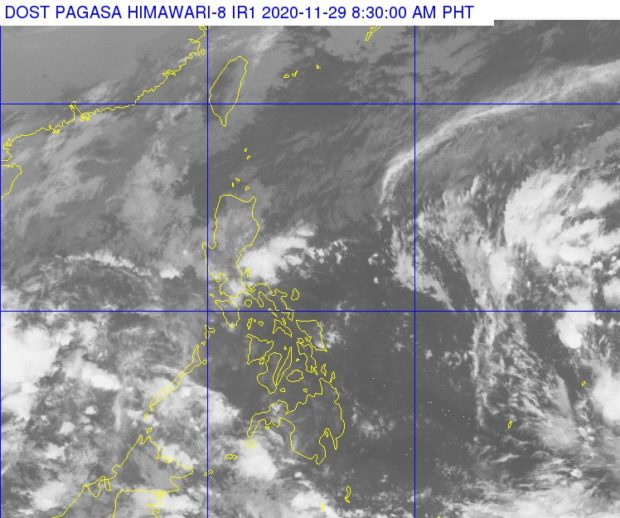
MANILA, Philippines — A low-pressure area (LPA) east of Mindanao may enter the Philippine area of responsibility (PAR) within the next 24 hours, the state weather bureau said Sunday morning.
The Philippine Atmospheric, Geophysical, and Astronomical Services Administration (Pagasa) reported in its daily weather forecast that the LPA was spotted 1,500 kilometers east of Mindanao as of 4 a.m.
Although unlikely to develop into a tropical depression, the LPA will bring rains to the Visayas and Southern Luzon, according to Pagasa weather forecaster Benison Estareja.
“Nakikita na itong low pressure area ay papasok ng Philippine area of responsibility sa susnod na 24 oras or within this day. Maaaring mamayang hapon o gabi,” Estareja said.
Meanwhile, the tail-end of a frontal system or the interaction of cold air and warm air from the Pacific Ocean will bring scattered rains and thunderstorms to Cagayan Valley, Cordillera Administrative Region, Aurora, Quezon, and the Bicol region on Sunday, Pagasa said.
Metro Manila, Ilocos region, the rest of Central Luzon and Calabarzon region (Cavite, Laguna, Batangas, Rizal, Quezon) will experience cloudy skies with rains due to the northeast monsoon or “amihan”.
As for the rest of the country, the esterlies or warm winds form the Pacific region is expected to bring isolated rains or thunderstorms. / gsg
Disclaimer: The comments uploaded on this site do not necessarily represent or reflect the views of management and owner of Cebudailynews. We reserve the right to exclude comments that we deem to be inconsistent with our editorial standards.

