MGB-7 to LGUs: Use geohazard maps to prepare for TS Auring
As Tropical Storm Auring nears Cebu and the Visayas, local government units (LGUs) are advised to refer to the geohazard maps to effectively map out contingency measures against the first weather disturbance to enter the country.
CEBU CITY, Philippines — The Mines and Geosciences Bureau in Central Visayas (MGB-7) is urging local government units (LGUs) to refer to the geohazard map to identify areas that need more attention for the incoming Tropical Storm Auring.
The geohazard map can be accessed at www.mgb.gov.ph and will show the landslide and flood-prone areas in each locality, which can be used as a guide on whether or not to evacuate residents of a certain barangay or sitio.
The LGUs already have a copy of the map since 2015, and MGB-7 said it is continually conducting an update on the vulnerability and risk assessment related to geohazard mapping.
MGB is also updating the scale of the geohazard map to provide local government units (LGUs) and development planners with a more detailed and higher resolution image.
“Our ultimate goal is zero casualty. The geohazard maps can greatly help and guide our officials to conduct appropriate precautionary measures to achieve that,” Armando L. Malicse, OIC-Regional Director MGB-7 said.
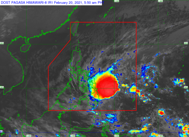
Even though Auring has slightly weakened, the Philippine Atmospheric Geophysical and Astronomical Services Administration (PAGASA) said in its 5:00 a.m. weather bulletin that it will bring moderate to heavy rains in Visayas and Mindanao.
Tropical Cyclone Wind Signal (TCWS) No. 1 has been raised in the Visayas as around 30 to 60 kilometers per hour (kph) of wind is expected in the next 36 hours.
MGB 7 also urged residents in high-risk areas such as coastlines, near riverbanks and steep slopes to follow advisories on possible evacuation from their mayors or barangay officials to avoid any casualties.
Auring is expected to pass Cebu on Sunday, February 21, 2021. Cebu has already been placed under Signal No. 1. /rcg
Disclaimer: The comments uploaded on this site do not necessarily represent or reflect the views of management and owner of Cebudailynews. We reserve the right to exclude comments that we deem to be inconsistent with our editorial standards.