Pagasa: ‘Nanmadol’ to enter PAR Friday afternoon, may reach super typhoon category
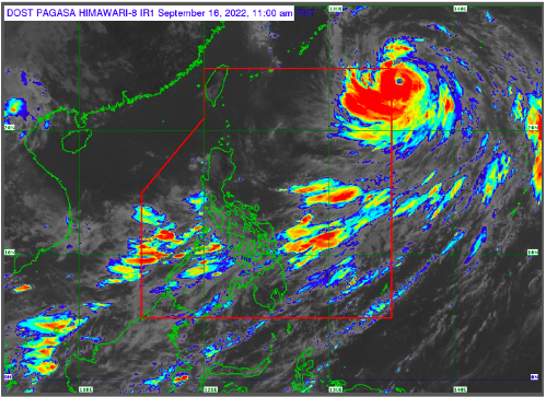
MANILA, Philippines — Typhoon Nanmadol will enter the Philippine area of responsibility (PAR) on Friday afternoon and may intensify into a super typhoon in the next 24 hours, according to the the Philippine Atmospheric, Geophysical and Astronomical Services Administration (Pagasa).
“On the track forecast, it may enter the PAR region this afternoon,” Pagasa said in its 11:00 a.m. advisory.
Once it enters PAR, the typhoon will be called “Josie.”
The eye of “Nanmadol” was estimated some 1,465 kilometers east-northeast of extreme Northern Luzon, packing maximum sustained winds of 165 kilometers per hour (kph) near the center and gustiness of up to 205 kph.
“Further intensification is forecast to occur throughout the forecast period. Nanmadol may reach to super typhoon category within 24 hours,”Pagasa added.
The typhoon, however, is not expected near the country’s landmass but will enhance the southwest monsoon or “habagat” which will trigger rains in Souther Luzon and parts of the Visayas and Mindanao.
gsg
Click here for more weather related news.
Disclaimer: The comments uploaded on this site do not necessarily represent or reflect the views of management and owner of Cebudailynews. We reserve the right to exclude comments that we deem to be inconsistent with our editorial standards.