Goring now a typhoon; Signal No. 2 up over northeastern Cagayan
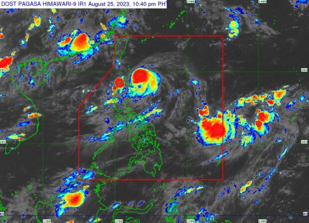
Typhoon Goring was last located 205 km east of Calayan, Cagayan. (Satellite image from Pagasa)
MANILA, Philippines — Typhoon Goring intensified anew prompting state meteorologists to raise Signal No. 2 over the northeastern part of Cagayan province.
The bulletin from the Philippine Atmospheric, Geophysical and Astronomical Services Administration (Pagasa) on Friday night showed that Goring now packs maximum sustained winds of 120 kilometers per hour (kph) near the center, and gustiness of up to 150 kph.
Goring was last located 205 km east of Calayan, Cagayan. It is now moving south southwest at a speed of 10 kph.
As of now, the town of Santa Ana in Cagayan is under Tropical Cyclone Wind Signal No. 2, which means the area may encounter wind speeds of 62 kph to 88 kph in the next 24 hours — leading to “minor to moderate threat to life and property.”
The following areas are under Tropical Cyclone Wind Signal No. 1:
- Batanes
- Babuyan Islands
- Eastern portion of mainland Cagayan (Gonzaga, Lal-Lo, Gattaran, Baggao, Peñablanca, Santa Teresita, Buguey, Camalaniugan, Aparri)
- Eastern portion of Isabela (Maconacon, Dinapigue, San Mariano, San Pablo, Cabagan, Tumauini, Ilagan City, Divilacan, Palanan)
- Northern portion of Aurora (Dilasag, Casiguran)
Pagasa expects around 100 millimeter (mm) to 200 mm rainfall from Friday night to Saturday evening over the extreme northeastern portion of mainland Cagayan.
However, Pagasa still does not expect Goring to make landfall but it would intensify the southwest monsoon or habagat, causing rains and bringing gusty winds over Aurora, Bataan, Metro Manila, Calabarzon, Bicol Region and most of Mimaropa on Saturday.
The latest track also shows that Goring will remain a typhoon-category cyclone as it moves southeast until Sunday.
Then after turning north Monday morning to complete its roundabout, Goring will intensify into a super typhoon.
It will remain a super typhoon-category cyclone until Tuesday night, before weakening into a typhoon as it moves closer to the eastern portion of Taiwan.
“Due to highly favorable environment, Goring is forecast continue intensifying throughout most of the forecast period and may reach super typhoon category on Monday,” Pagasa said.
“Considering these developments, the public and disaster risk reduction and management offices concerned are advised to take all necessary measures to protect life and property. Persons living in areas identified to be highly or very highly susceptible to these hazards are advised to follow evacuation and other instructions from local officials,” it added.
RELATED STORIES
Goring now a severe tropical storm, may become typhoon by Saturday — Pagasa
LIVE UPDATES: Typhoon Goring
Disclaimer: The comments uploaded on this site do not necessarily represent or reflect the views of management and owner of Cebudailynews. We reserve the right to exclude comments that we deem to be inconsistent with our editorial standards.