LIST: Class suspensions in Cebu due to tropical storm Kristine

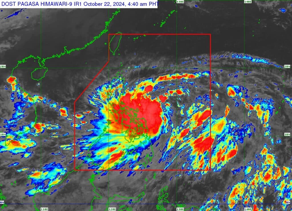
Pagasa satellite image
CEBU CITY, Philippines (UPDATED) – Classes in several areas in Cebu are still suspended on Wednesday, October 23 due to bad weather brought by Tropical Storm #KristinePH.
As of 8 a.m., physical classes have been suspended in at least 28 localities, including the capital Cebu City.
- Alcoy
- Alegria
- Argao
- Asturias
- Badian
- Balamban
- Barili
- Carcar City
- Carmen
- Cebu City
- Compostela
- Consolacion
- Cordova
- Daanbantayan
- Dalaguete
- Danao
- Ginatilan
- Lapu-Lapu
- Liloan
- Malabuyoc
- Mandaue
- Minglanilla
- Poro
- Santander
- Sibonga
- Talisay City
- Toledo City
- Tuburan
KRISTINE UPDATE (Oct. 23)
The state weather bureau has hoisted Storm Signals in several areas in Cebu as Tropical Storm Kristine moves closer to northern Luzon on Wednesday, October 23.
The Philippine Atmospheric Geophysical and Astronomical Services Administration (Pagasa) placed a total of 38 localities in the northern and central portions under Tropical Cyclone Wind Signal (TCWS) No. 1 in.
These are Alcantara, Argao, Dumanjug, Sibonga, Pinamungahan, Ronda, Liloan, Cebu City, Moalboal, Consolacion, Danao City, Borbon, Carmen, Daanbantayan, Tuburan, City of Bogo, Tabogon, City of Naga, Lapu-Lapu City, City of Carcar, Mandaue City, Catmon, Minglanilla, Toledo City, Cordova, Compostela, San Remigio, Balamban, Aloguinsan, San Fernando, Asturias, Barili, Medellin, Sogod, Tabuelan, City of Talisay.
Pagasa has also included Bantayan and Camotes group of islands under Storm Signal No. 1
Under TCWS No. 1, residents are expected to experience moderate to strong wind that packs speeds ranging between 30 and 60 kilometers per hour (kph).
“Minimal to minor impacts from strong winds are possible within any of the areas under Wind Signal No. 1,” Pagasa warned.
Kristine was last spotted 310 kilometers East of Baler, Aurora or 310 kilometers East Northeast of Infanta, Quezon.
The tropical storm has maintained its strength, packing wind with speed of 85 kph and gustiness reaching up to 105 kph, as it moves west-northwestward over the sea east of Quezon.
Kristine is forecasted to make landfall over Isabela or northern Aurora between Wednesday evening and Thursday morning, October 24.
READ MORE
Tropical storm Kristine: LIVE UPDATES
EXPLAINER: What do color-coded rainfall warnings mean?
Disclaimer: The comments uploaded on this site do not necessarily represent or reflect the views of management and owner of Cebudailynews. We reserve the right to exclude comments that we deem to be inconsistent with our editorial standards.
