Pagasa: Typhoon Julian re-enters PAR, no direct effect on PH
However, Batanes will be affected by the typhoon's re-entering PH
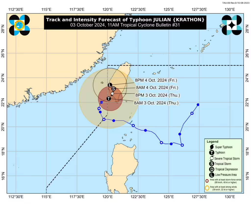
(Track of typhoon Julian from DOST)
MANILA, Philippines — The state weather bureau said on Thursday that Typhoon Julian had re-entered the Philippine Area of Responsibility (PAR).
This Thursday at 8 a.m. Julian entered PAR and was estimated at 245 kilometers (km) northwest of Itbayat, Batanes, said the Philippine Atmospheric, Geophysical, and Astronomical Services Administration (Pagasa).
READ MORE:
Typhoon Krathon makes landfall: Taiwan shuts down for second day
EXPLAINER: What do color-coded rainfall warnings mean?
Hurricane Helene death toll hits 130
Pagasa said in its 11:00 am. cyclone bulletin that Julian was moving east northeastward, packing maximum sustained winds of 120 kilometers per hour (kph) with gusts of up to 165 kph.
“Despite its re-entry in the PAR region, no direct effect is anticipated over the country except for Batanes, which is relatively close to Taiwan,” state meteorologists said.
Batanes remains under Tropical Cyclone Wind Signal (TCWS) No. 1, where wind speeds of 39 to 61 kph may be expected.
“Pinapaalalahanan pa rin po natin ang mga kababayan po natin dito sa Batanes na possible pa rin po ang malalakas na hangin at mga pabugso-bugso na pag-ulan,” state weather specialist Chenel Dominguez said in a press briefing on Thursday.
(We are reminding our fellow citizens in Batanes that strong winds and occasional heavy rains are still possible.)
READ MORE: Typhoon Julian to reenter PAR border before Taiwan landfall
According to Pagasa, typhoon Julian is expected to make landfall over southwestern Taiwan on Thursday afternoon.
“After landfall, Julian is forecast to move erratically over Taiwan while rapidly weakening due to land interaction. This tropical cyclone is forecast to become a remnant low over Taiwan tomorrow (4 October),” the state weather bureau noted.
Julian may exit the PAR on Friday.
“Possible din po na ito po ay mag dissipate or lumabas din po ng ating Philippine Area of Responsibility (PAR) by Friday,” Dominguez added.
Pagasa hoisted a gale warning over the northern seaboard of Northern Luzon.
Disclaimer: The comments uploaded on this site do not necessarily represent or reflect the views of management and owner of Cebudailynews. We reserve the right to exclude comments that we deem to be inconsistent with our editorial standards.