Phivolcs: No ‘Taal-like’ magmatic eruption expected of Kanlaon yet
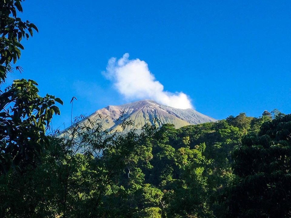
Kanlaon Volcano (Photo from Mt. Kanlaon Natural Park Facebook page)
CEBU CITY, Philippines — Kanlaon Volcano is not yet expected to display magmatic eruptions as big as those recently experienced in Taal Volcano.
Engineer Andylene Quintia, resident volcanologist of the Kanlaon Volcano Observatory, said the hoisting of an Alert Level 1 in Kanlaon Volcano is still classified as a “low-level” of volcanic unrest.
The Philippine Institute of Volcanology and Seismology (Phivolcs), in its Alert Level 1 advisory issued Wednesday, March 11, 2020, said they recorded 80 volcanic earthquakes linked to Mount Kanlaon since March 9.
Read: Kanlaon now under Alert Level 1 – Phivolcs
“This could be a sign of changes in the hydrothermal, or magmatic or tectonic processes underneath the volcano at a shallow level,” Quintia told CDN Digital.
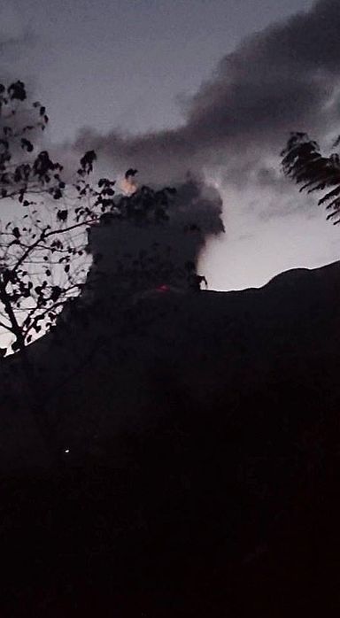
A photo of Mount Kanlaon on MARCH 29, 2016 when it spewed ash and fiery rocks.| Photo courtesy of Canlaon Mountain Tigers Search and Rescue on its FB page
“At this point, magmatic eruption (as big as Taal’s) is not yet expected. However, phreatic or steam and ash eruptions are possible. This is because the volcano is made up of hot materials. It could heat up its water sources and form a steam,” she added.
In the case of ashfalls, Quintia said the extent of the effects would be dependent on the wind direction and prevailing wind speed in the Visayas.
The volcano is situated 188 kilometers north of Dumaguete City, the largest city in Negros Oriental, and 92 kilometers south of Bacolod City, the largest city in Negros Occidental.
Jhomer Eclarino, a weather specialist at the Mactan Station of the Philippine Atmospheric Geophysical and Astronomical Services Administration (Pagasa), said the prevailing winds in the Visayas comes from east to northeast.
“Kung ang hangin is blowing from east to northeast, ibig sabihin padulong siya sa may southwest or sa west,” Eclarino said in a separate interview.
At present, the winds in the Visayas blow within 20 to 30 kilometers per hour, Eclarino added.
Meanwhile, in the case of a magmatic eruption like that of Taal, Quintia said: “Lava flow, pyroclastic density currents, and lahar could be possible.”
“PHIVOLCS has produced hazard maps which you can find online using hazardhunterph. These hazard maps locate areas that are prone to Kanlaon Volcano Hazards. Areas near the volcano, La Castellana, La Carlota, Bago City, Murcia, Moises Padilla, San Carlos City, and Canlaon City would be highly affected,” Quintia added. /rcg
Disclaimer: The comments uploaded on this site do not necessarily represent or reflect the views of management and owner of Cebudailynews. We reserve the right to exclude comments that we deem to be inconsistent with our editorial standards.