LPA may affect Mindanao by weekend; rain looms over eastern PH due to frontal system
MANILA, Philippines — Eastern parts of the country, especially near the Bicol Region, may experience rain and thunderstorms because of the tail-end of a frontal system, or the area where cold and dry winds from the northeast monsoon and warm, damp winds from easterlies meet.
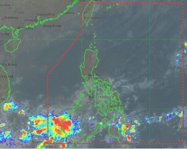
Aside from that, the Philippine Atmospheric, Geophysical and Astronomical Services Administration (Pagasa) said on its Tuesday afternoon weather forecast that a low-pressure area (LPA) might affect the Visayas and Mindanao over the weekend.
No tropical cyclone is seen near the country, but cloud clusters east of Mindanao are moving closer to the Philippine area of responsibility (PAR).
“In the next two to three days wala pa naman tayong nakikitang sama ng panahon na posibleng mabuo o pumasok sa loob ng Philippine area of responsibility, bagamat this weekend posibleng isang low pressure area ang maka-apekto dyan sa bahagi ng Visayas at sa Mindanao,” weather specialist Ariel Rojas said.
(In the next two to three days, we are not expecting any weather disturbance that may enter the Philippine area of responsibility, although this weekend, a low-pressure area may affect Visayas and Mindanao areas.)
Areas in eastern Luzon like Cagayan Valley, Southern Luzon, and Bicol are still affected by the northeast monsoon or Amihan. At the same time, easterlies may cause rain Davao Region, Northern Mindanao, and Caraga Region.
Weather for the remaining areas on Wednesday remains clear and warm at times, except for occasional rain showers by afternoon and night. Temperatures in Metro Manila may drop from 32 to 22 degrees Celsius. In Tagaytay, it would be between 21 and 29 degrees.
It would also be colder in Tuguegarao with 22 to 29 degrees Celsius. Legazpi may feel temperatures from 26 to 32 degrees. It would be 26 to 33 degrees in Puerto Princesa, and in Laoag, 24 to 34 degrees.
The Eastern parts of the Visayas and Mindanao would have colder temperatures due to the rain, as temperatures of both Tacloban and Davao may range from 24 to 31 degrees Celsius, compared to Cebu’s 25 to 32 degrees, Zamboanga’s 24 to 34 degrees, and Cagayan de Oro’s 23 to 33 degrees.
Gale warnings remain in place over the entire eastern seaboards of Luzon and Eastern Visayas, stretching from Cagayan to Northeastern Quezon, Bicol Region, and northeast and eastern seaboards of Eastern Visayas.
Similar conditions are in play on the extreme Northern Luzon area plus the western coastlines of Ilocos Norte and Ilocos Sur. [ac]
Disclaimer: The comments uploaded on this site do not necessarily represent or reflect the views of management and owner of Cebudailynews. We reserve the right to exclude comments that we deem to be inconsistent with our editorial standards.