Queenie intensifies into a storm

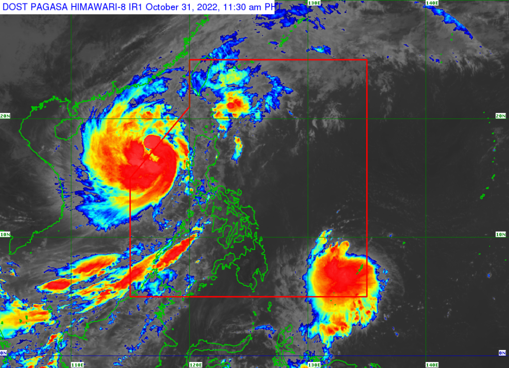
Satellite image of Tropical Storm Queenie (east of Mindanao) while Severe Tropical Storm Paeng can be seen northwest of Luzon. | Photo from Pagasa
CEBU CITY, Philippines – While the country is still reeling from the effects of Tropical Storm Paeng (international codename: Nalgae), another major weather disturbance threatens to destruct properties.
The state weather bureau on Monday, October 31, announced that Queenie, the Tropical Depression being monitored east of Mindanao, has intensified into a Tropical Storm as of 8 a.m. on Monday.
In its 11 a.m. severe weather bulletin, the Philippine Atmospheric Geophysical and Astronomical Services Administration (Pagasa) said Queenie was spotted 815 kilometers East of Northeastern Mindanao at 10 a.m. on Monday.
Queenie packs winds up to 65 kilometers per hour (kph), with gustiness reaching up to 85 kph.
Pagasa said portions of the country – particularly the Caraga, Eastern Visayas, and Bicol regions – may start to experience its effects starting this Wednesday, November 2.
“Based on the latest forecast scenario, Tropical Cyclone Wind Signal may be hoisted over the eastern portion of Caraga and in some areas in Eastern Visayas tomorrow evening (November 1) at the earliest,” they added.
The state weather bureau forecasted that Queenie may further intensify in the next 12 hours however it may also weaken right after.
“It may further intensify in the next 12 hours. However, weakening trend is likely by tomorrow evening or Wednesday. Weakening into a remnant low is likely on Friday as it approaches Caraga or Eastern Visayas,” explained Pagasa.
RELATED STORIES
WATCH: Datu Odin Sinsuat submerged in deep flood due to Paeng’s fury
Aklan, Capiz town declare state of calamity due to Paeng
DSWD-7 assists 250 individuals stranded in Cebu City ports due to Paeng
/dcb
Disclaimer: The comments uploaded on this site do not necessarily represent or reflect the views of management and owner of Cebudailynews. We reserve the right to exclude comments that we deem to be inconsistent with our editorial standards.
