| Pagasa
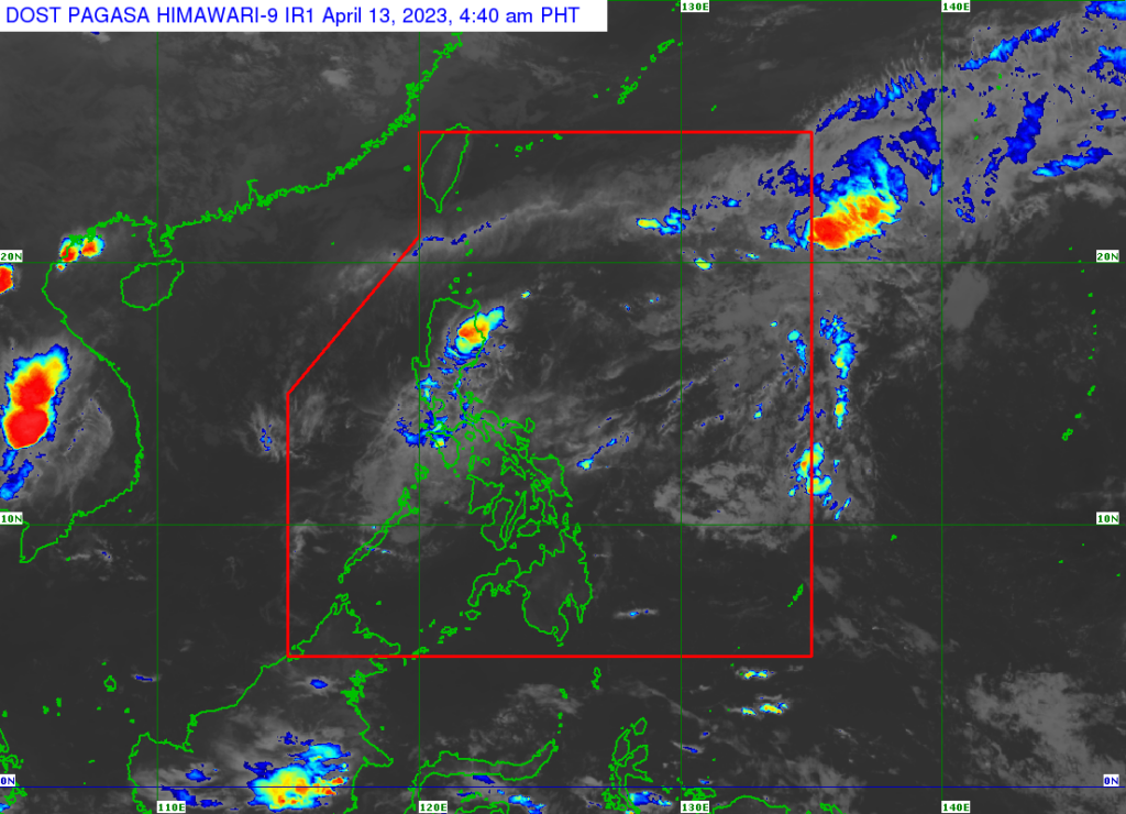
Tropical depression Amang is forecast to weaken into a low pressure area within the day as it moves over Camarines Norte towards Lamon Bay, Polillo Islands, and the northern portion of mainland Quezon, a bulletin from the weather bureau said.
According to the bulletin, the location of the center as of 4 a.m. on Thursday, April 13, 2023, was estimated to be in the vicinity of Vinzons, Camarines Norte.
The tropical depression brings maximum sustained winds of 45 km/h near the center, gustiness of up to 55 km/h, and central pressure of 1006 hPa, the Philippine Atmospheric Geophysical and Astronomical Services Administration (Pagasa) said.
It is moving west northwestward at 10 km/h.
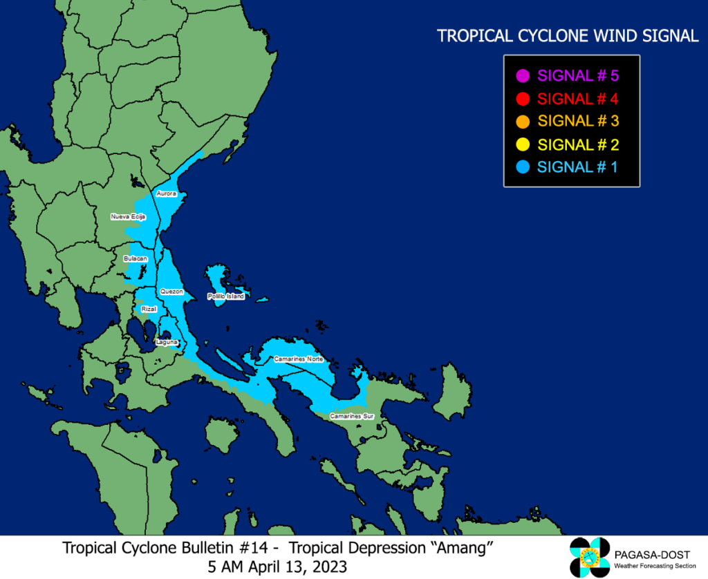
Tropical Cyclone Wind Signal is still in effect in these areas:
Camarines Norte, the northwestern portion of Camarines Sur (Sipocot, Cabusao, Bombon, Calabanga, Tinambac, Siruma, Lupi, Ragay, Del Gallego), the eastern portion of Laguna (Cavinti, Kalayaan, Paete, Pangil, Siniloan, Famy, Santa Maria, Lumban, Pakil, Mabitac), the northern and eastern portions of Quezon (Calauag, Infanta, Lopez, Plaridel, Quezon, Alabat, Sampaloc, Mauban, General Nakar, Perez, Gumaca, Atimonan, Real, Tagkawayan, Guinayangan) including Polillo Islands, the eastern portion of Rizal (Tanay, Rodriguez), the eastern portion of Bulacan (Norzagaray, Doña Remedios Trinidad), the eastern portion of Nueva Ecija (Gabaldon, General Tinio), and the central and southern portions of Aurora (Dingalan, Baler, Maria Aurora, San Luis, Dipaculao)

| Pagasa
Amang is the first tropical depression in the country this year.
READ MORE:
Cebu gets fair weather as Amang may weaken to LPA
Disclaimer: The comments uploaded on this site do not necessarily represent or reflect the views of management and owner of Cebudailynews. We reserve the right to exclude comments that we deem to be inconsistent with our editorial standards.
