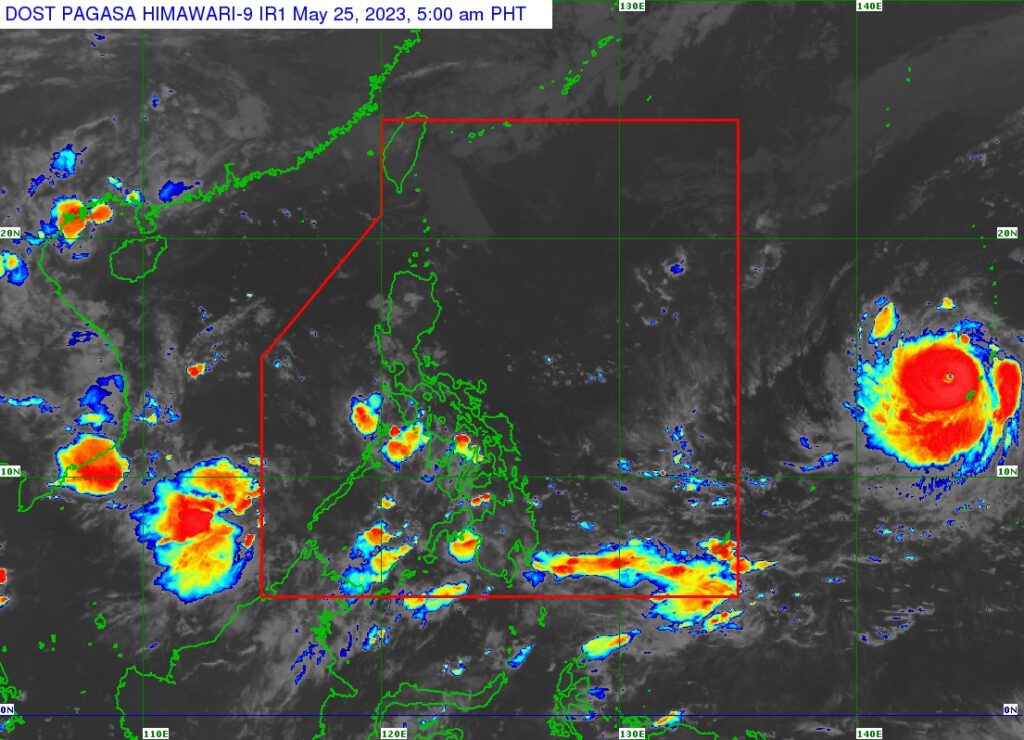
Satellite image from Pagasa
The Philippine Atmospheric, Geophysical and Astronomical Services Administration (Pagasa) said in an advisory on Thursday, May 25, 2023, that Mawar re-intensified into a super typhoon.
In a 5 a.m. advisory, it said Mawar re-intensified into a super typhoon as it moved away from Guam in the Northern Mariana Islands.
The location of the center of the eye at 4 a.m. was estimated to be 2,130 km east of Southeastern Luzon.
It brings maximum sustained winds of 185 km/h near the center, gustiness of up to 230 km/h, and central pressure of 930 hPa.
Mawar, the advisory said, is moving west northwestward at 15 km/h.
Strong to typhoon-force winds extend outwards up to 390 km from the center.
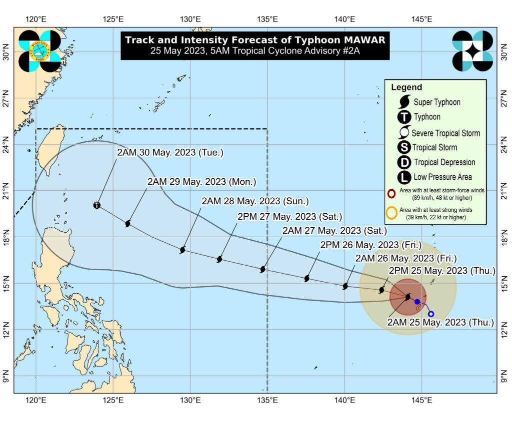
Super Typhoon Mawar is forecast to track generally west northwestward throughout the forecast period towards the sea area east of extreme northern Luzon. On the forecast track, Mawar will enter the Philippine Area of Responsibility (PAR) on Friday evening or on Saturday morning. Once it enters the PAR, the typhoon will be given the local name “Betty.”

Image from Pagasa
The advisory also stated that Mawar is forecast to continue intensifying in the next three days and may reach a peak intensity of 215 km/h by Sunday. Afterwards, the super typhoon is forecast to weaken although it will remain a typhoon.
Mawar was downgraded into a typhoon on Wednesday.
READ MORE:
Pagasa downgrades ‘Mawar’ into typhoon category
Cebu prepares for Mawar’s effects
Disclaimer: The comments uploaded on this site do not necessarily represent or reflect the views of management and owner of Cebudailynews. We reserve the right to exclude comments that we deem to be inconsistent with our editorial standards.
