Gener update: TD maintains strength while moving over N. Luzon
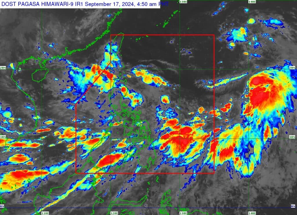
Satellite image of Pagasa showing update on TD Gener.
Tropical Depression #GenerPH has maintained its strength while moving westward over northern Luzon based on the latest bulletin of the weather bureau on Tuesday morning, September 17, 2024.
In Pagasa’s 5 a.m. bulletin, the location of center at 4 a.m. was estimated to be in the vicinity of Alicia, Isabela, packing maximum sustained winds of 55 kilometers per hour (km/h) near the center, gustiness of up to 70 km/h, and central pressure of 996 hPa.
READ MORE:
TD Gener to make landfall in Isabela or Aurora – Pagasa
Gener’s present movement is westward at 30 km/h.
Strong winds extend outwards up to 360 kilometers from the center of Gener.
GENER: TROPICAL CYCLONE WIND SIGNALS (TCWS) IN EFFECT
TCWS No. 1
Luzon
Cagayan including Babuyan Islands, Isabela, Quirino, Nueva Vizcaya, Apayao, Kalinga, Abra, Ifugao, Mountain Province, Benguet, Ilocos Norte, Ilocos Sur, La Union, Pangasinan, Zambales, Tarlac, Nueva Ecija, Pampanga, Bulacan, the northern and central portions of Bataan (Dinalupihan, Orani, Hermosa), Aurora, the northern portion of Quezon (General Nakar, Infanta) including Polillo Islands, the northern portions of Rizal (Rodriguez, San Mateo), and the northern portion of Metro Manila (Quezon City, Caloocan City, City of Valenzuela, City of Malabon, City of Navotas, City of Marikina, City of Manila, City of San Juan, City of Mandaluyong)
Severe Winds
The Southwest Monsoon enhanced by TD GENER and TS “PULASAN” will bring strong to gale-force gusts over the following areas (especially in coastal and upland areas exposed to winds):
Sept. 17:
Batanes, MIMAROPA, Bicol Region, Visayas, and Mindanao.
Sept. 18: Zambales, Bataan, Pampanga, Bulacan, Metro Manila, CALABARZON, MIMAROPA, Bicol Region, Visayas, and Mindanao.
Sept. 19: Isabela, Aurora, Pangasinan, Zambales, Bataan, Metro Manila, CALABARZON, MIMAROPA, Bicol Region, Western Visayas, and Caraga
GENER: TRACK AND INTENSITY OUTLOOK
GENER is forecast to emerge over the coastal waters of Ilocos Sur or La Union today, Sept. 17.
The tropical cyclone will then move generally westward over the West Philippine Sea until Thursday, September 19, before turning west northwestward as it heads towards southern China.
GENER may exit the Philippine Area of Responsibility (PAR) between Tuesday night and Wednesday morning.
GENER will likely cross the landmass of mainland Luzon as a tropical depression, Pagasa said.
Slight weakening is also possible as it interacts with the mountainous terrain of northern Luzon.
Disclaimer: The comments uploaded on this site do not necessarily represent or reflect the views of management and owner of Cebudailynews. We reserve the right to exclude comments that we deem to be inconsistent with our editorial standards.