Pagasa warns of flooding, lahar from Kanlaon due to ‘Querubin’

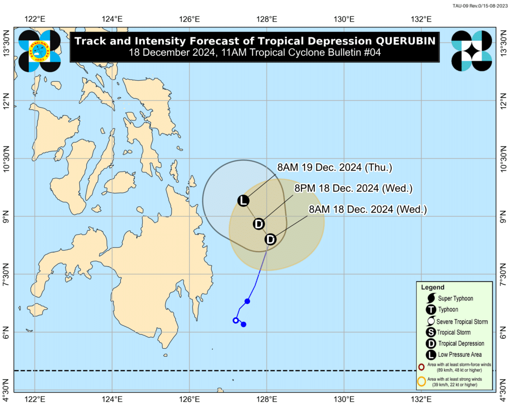
Querubin track
MANILA, Philippines – Tropical Depression Querubin is expected to weaken into a remnant low within 24 hours, but it could still pose risks of flooding and lahar flows from the Kanlaon Volcano on Friday, the weather bureau warned Wednesday.
“The remnant low is expected to be very near Mt. Kanlaon by Friday, so those living near the volcano should take extra precautions against possible flooding and lahar,” Veronica Torres, weather specialist of the Philippine Atmospheric, Geophysical and Astronomical Services Administration (PAGASA), said in a briefing before noon.
The weather bureau advised residents near Kanlaon to remain vigilant.
READ MORE:
Kanlaon Volcano emits ash anew
Kanlaon eruption poses potential health risks – DOHKanlaon evacuees: Negros appeals for help
Querubin’s remnants are expected to continue bringing rains over much of Visayas and Mindanao, including the Sulu Sea and Palawan, which are part of its forecast track.
As of 10 a.m., Querubin was located 195 km. east of Hinatuan, Surigao del Sur, with maximum sustained winds of 45 km. per hour (kph) and gustiness of up to 55 kph.
Tropical Cyclone Wind Signal No. 1 remains in effect in Surigao del Sur.
Heavy to intense rains are forecast in Northern Samar, Eastern Samar, Dinagat Islands, Surigao del Norte, and Surigao del Sur. Moderate to heavy rains will impact Quezon, Bicol Region, Samar, Biliran, Leyte, Cebu, Bohol, Agusan del Norte, Misamis Oriental, and Davao Oriental.
PAGASA also issued a sea travel warning for vessels navigating very rough seas in Batanes, Cagayan, and the northern seaboard of Ilocos Norte.
“Residents in hazard-prone areas should prepare for possible flooding and landslides,” Torres said. (PNA)
Disclaimer: The comments uploaded on this site do not necessarily represent or reflect the views of management and owner of Cebudailynews. We reserve the right to exclude comments that we deem to be inconsistent with our editorial standards.
