New LPA outside PAR unlikely to affect PH – Pagasa-Mactan

Pagasa photo
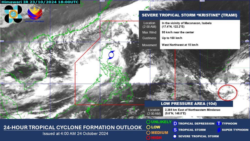
CEBU CITY, Philippines — The low-pressure area (LPA) recently formed outside the Philippine Area of Responsibility (PAR) has a high chance of developing into a tropical depression within the next 24 hours, according to a weather specialist from the state weather bureau.
Vhan Sabellano, a weather specialist of the Philippine Atmospheric, Geophysical and Astronomical Services Administration (Pagasa-Mactan), said that once it enters PAR within the next 24 hours, it will be named Leon.
Based on their latest monitoring at around 8:40 a.m. on Thursday, Oct. 24, the LPA is unlikely to affect the Philippine landmass, according to Sabellano.
“Pero adto paman sad siya sa babaw pa hinuon. Dili siya muduol (sa landmass) unya igo lang siya na mo re-curve padung na siya sa Japan,” Sabellano said.
READ: Kristine: LIVE UPDATES
Storm Kristine maintains strength; Signal No. 3 still up over 12 areas
Meanwhile, PAGASA lifted Storm Signal No. 1 in Cebu on Thursday as Severe Tropical Storm Kristine passed through the Cordillera Administrative Region (CAR).
As of 7 a.m. on Thursday, the center of STS Kristine was located in the vicinity of Aguinaldo, Ifugao, with maximum sustained winds of 95 km/h near the center, gusts of up to 160 km/h, and a central pressure of 985 hPa.
Kristine is expected to cross northern Luzon over the next 12 hours and may move over the waters west of the Ilocos Region by Thursday afternoon or evening.
It will then continue west-northwest over the West Philippine Sea and exit PAR on Friday afternoon, October 25. /clorenciana
Disclaimer: The comments uploaded on this site do not necessarily represent or reflect the views of management and owner of Cebudailynews. We reserve the right to exclude comments that we deem to be inconsistent with our editorial standards.
