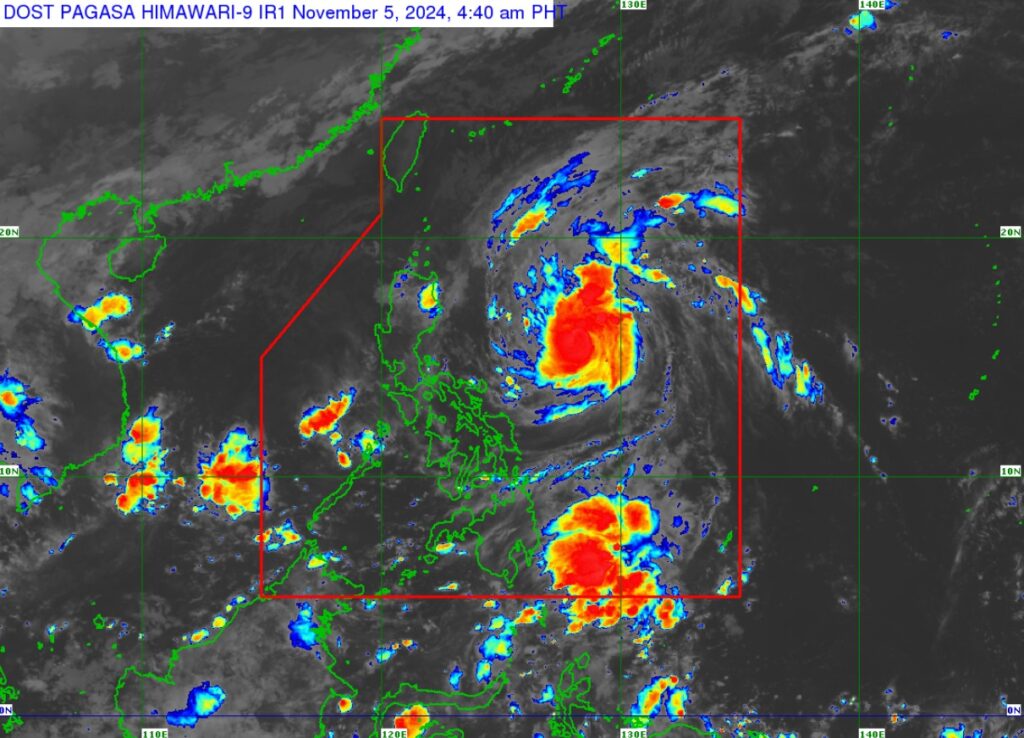
Satellite image of Marce as of early Tuesday, November 5, 2024. | Pagasa image
Severe Tropical Storm Marce ( International name: YINXING), has slightly intensified and is nearing typhoon category based on the 5 a.m. update of Pagasa on Tuesday, November 5, 2024.
According to Pagasa’s bulletin, as of 4 a.m. Tuesday, Marce packs maximum sustained winds of 110 kilometers per hour (km/h) near the center, which is estimated at 735 km east of Baler, Aurora.
READ MORE:
Marce may become typhoon before landfall in Northern Luzon
LIST: Philippine Typhoon Names for 2024
Marce also brings gustiness of up to 135 km/h, and has a central pressure of 975 hPa.
Mace is moving northwestward at 25 km/h.
Pagasa said in its update that Marce is currently undergoing rapid intensification.
“This tropical cyclone is expected to continue to rapidly intensify and may reach typhoon category today (Tuesday).
The bulletin also said that Marce is expected to reach its peak intensity prior to possible landfall over Babuyan Islands of Cagayan.
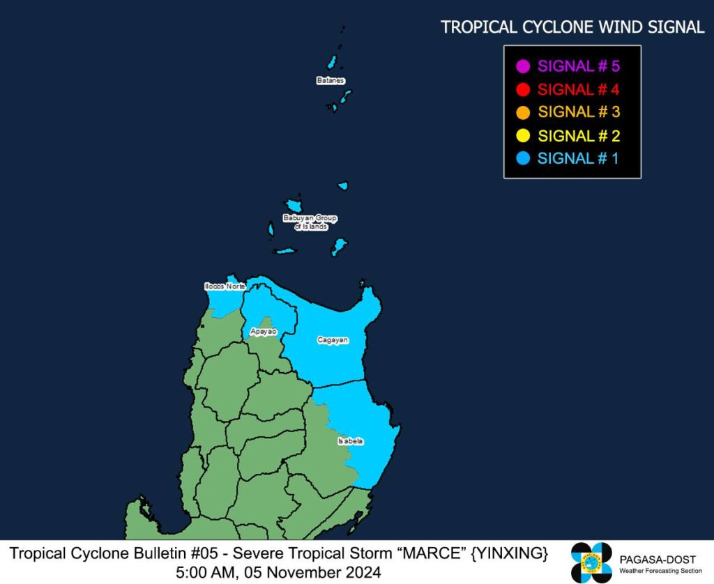
TROPICAL CYCLONE WIND SIGNALS (TCWS) IN EFFECT

Pagasa image
Marce: Signal No. 1
Luzon:
-Batanes, Cagayan including Babuyan Islands, the northern and eastern portions of Isabela (Maconacon, San Pablo, Palanan, Dinapigue, Santa Maria, Cabagan, Tumauini, Santo Tomas, Ilagan City, Divilacan, San Mariano), the northern portion of Apayao (Santa Marcela, Luna, Calanasan, Flora, Pudtol), and the northern portion of Ilocos Norte (Pagudpud, Dumalneg, Adams, Bangui, Burgos, Pasuquin, Vintar)
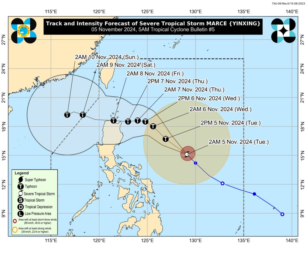
Marce’s track and intensity outlook

Pagasa image
According to the Pagasa bulletin, Marce is forecast to move generally west northwestward Tuesday until Wednesdaymorning before decelerating and turning westward over the Philippine Sea east of extreme Northern Luzon.
On the forecast track, Marce may make landfall in the vicinity of Babuyan Islands or over the northern portion of mainland Cagayan on Thursday evening, November 7, or Friday morning, November 8.
Due to uncertainty in the strength of the high pressure area north of MARCE, the forecast track may still change and bring the landfall point to mainland Cagayan-Isabela area.
MARCE may exit the Philippine Area of Responsibility (PAR) region on Friday evening or Saturday early morning, November 9.
Disclaimer: The comments uploaded on this site do not necessarily represent or reflect the views of management and owner of Cebudailynews. We reserve the right to exclude comments that we deem to be inconsistent with our editorial standards.
