Pagasa: Typhoon may form inside PAR between Dec. 16 and 22

Cloudy skies. – A typhoon may form inside the Philippine area of responsibility (PAR) between December 16 and 22, 2024, the Philippine Atmospheric, Geophysical and Astronomical Services Administration (Pagasa) says on Tuesday, December 10. STOCK PHOTO/INQUIRER FILES
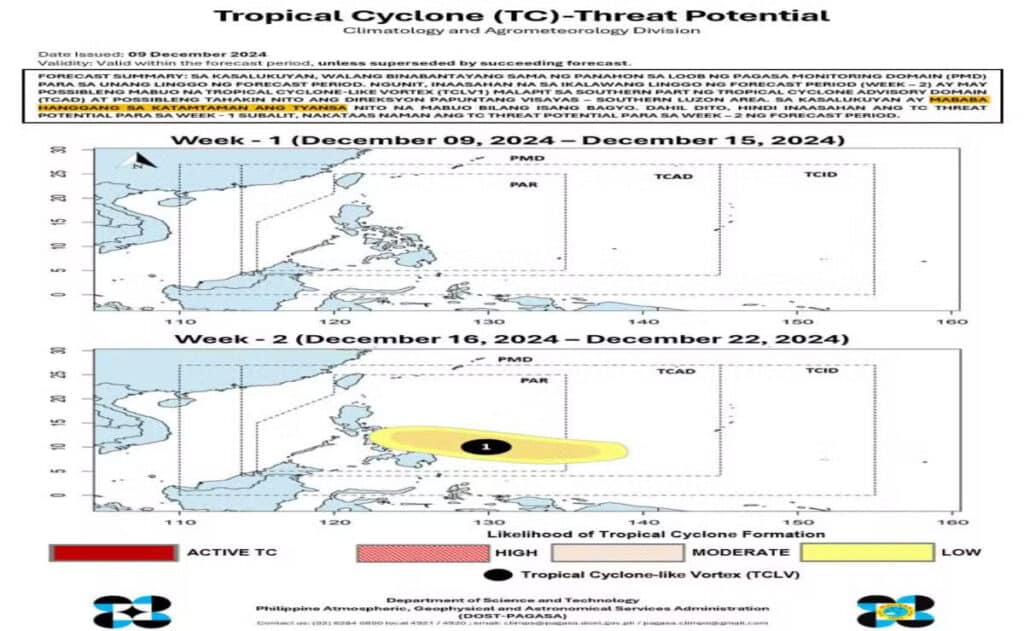
MANILA, Philippines — The state weather bureau said on Tuesday that a typhoon might form inside the Philippine area of responsibility (PAR) between December 16 and 22.
The typhoon will possibly affect Southern Luzon and Visayas, according to the Philippine Atmospheric, Geophysical and Astronomical Services Administration (Pagasa) in its latest typhoon cyclone threat potential forecast.
READ MORE:
Cloudy skies to prevail over most of PH Dec 10, says Pagasa
LIST: Philippine Typhoon Names for 2024
“Inaasahan na sa ikalawang linggo ng forecast period ay may posibleng mabuo na tropical cyclone-like vortex malapit sa southern part ng tropical cyclone advisory domain at posibleng tahakin nito ang direksyong papuntang Visayas at Southern Luzon area,” the state weather bureau said.
(It is expected that in the second week of the forecast period, a tropical cyclone-like vortex may form near the southern part of the tropical cyclone advisory domain and could potentially move toward the Visayas and Southern Luzon areas.)

Courtesy of DOST / Pagasa
However, Pagasa noted that this may still change since the forecast dates are far off.
“Dahil malayo pa, mataas pa po ‘yung chance na magbago ito from yesterday’s update,” Pagasa told INQUIRER.net in a phone interview on Tuesday.
(Since the dates are still far, there is a high chance that this could change compared to Monday’s update.)
The state weather agency added that the likelihood of a tropical cyclone developing remains low to moderate as of Tuesday, December 10.
“Sa ngayon, pinapakita naman na low to moderate likelihood,” Pagasa said.
(Currently, the likelihood is low to moderate.)
Should a new typhoon form within the next few days, it will be the 17th tropical cyclone to hit the Philippines this year and will be named “Querubin,” according to Pagasa.
In a separate bulletin, Pagasa said the combined effects of the shear line, northeast monsoon, and intertropical convergence zone will continue to bring cloudy skies and rain to many parts of the country on Tuesday.
Disclaimer: The comments uploaded on this site do not necessarily represent or reflect the views of management and owner of Cebudailynews. We reserve the right to exclude comments that we deem to be inconsistent with our editorial standards.
