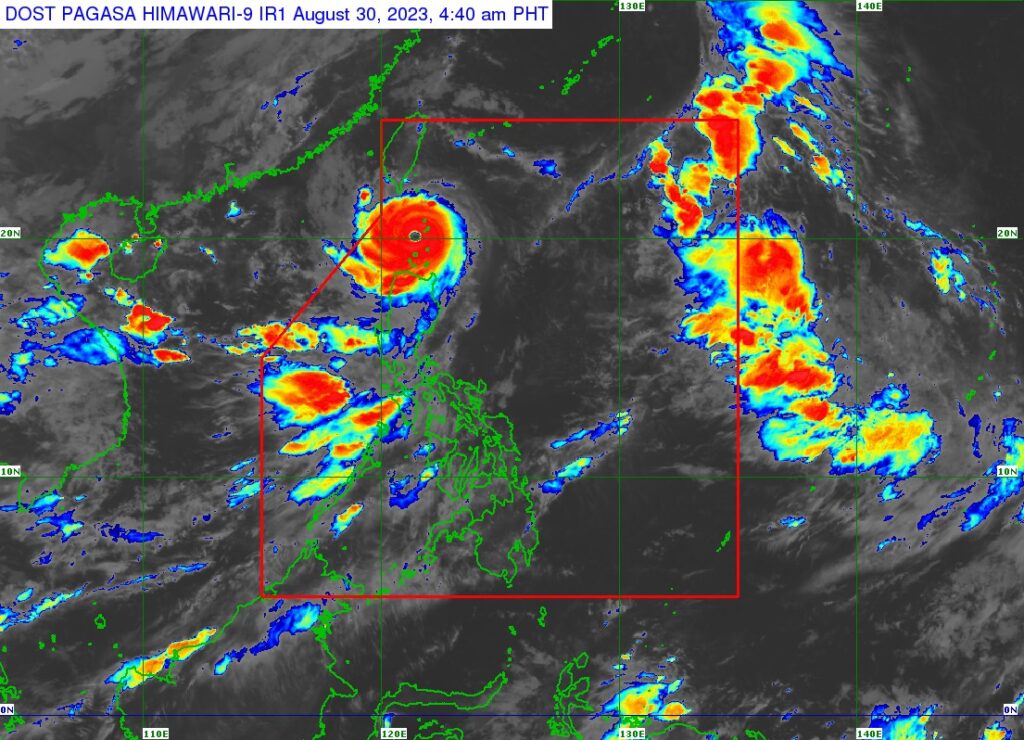
Goring (international name SAOLA) has become a super typhoon again and is moving northwestward over the Balintang Channel in the north, according to the 5 a.m. bulletin of Pagasa on Wednesday, August 30, 2023.
The location of the center of the eye of Super Typhoon Goring is over the coastal waters of Sabtang, Batanes, packing maximum sustained winds of 195 kilometers per hour (km/h) near the center and bringing gustiness of up to 240 km/h, and central pressure of 920 hPa.
TROPICAL CYCLONE WIND SIGNALS (TCWS) IN EFFECT
Signal No. 4
The southern portion of Batanes (Sabtang, Uyugan, Ivana, Mahatao, Basco) and the northern portions of Babuyan Islands (Calayan Is., Babuyan Is.)
Signal No. 3
Luzon
The rest of Batanes and the southwestern portion of Babuyan Islands (Fuga Is., Dalupiri Is.)
Signal No. 2
Luzon
The northern portion of mainland Cagayan (Santa Praxedes, Sanchez-Mira, Pamplona, Claveria, Abulug, Ballesteros, Santa Ana, Aparri, Camalaniugan, Buguey, Santa Teresita, Gonzaga), and the northern portion of Ilocos Norte (Pagudpud, Adams, Bangui, Dumalneg)
Signal No. 1
Luzon
The rest of Cagayan, Apayao, the northern portion of Kalinga (Balbalan, Pinukpuk, Rizal), the northern portion of Abra (Tineg, Lagayan, Lacub, Malibcong, San Juan, Danglas, La Paz), the rest of Ilocos Norte, and the extreme northern portion of Ilocos Sur (Sinait, Cabugao, San Juan)
The wind signals warn the public of the general wind threat over an area due to the tropical cyclone. Local winds may be slightly stronger/enhanced in coastal and upland/mountainous areas exposed to winds. Winds are less strong in areas sheltered from the prevailing wind direction, Pagasa said in its bulletin.
The enhanced Southwest Monsoon will continue to bring gusty conditions over the following areas not under any Wind Signal, especially in coastal and upland/mountainous areas exposed to winds:
• Wednesday: Ilocos Region, Cordillera Administrative Region, Zambales, Bataan, Bulacan, Aurora, Metro Manila, CALABARZON, MIMAROPA, Bicol Region, and Western Visayas
• Thursday and on Friday: Ilocos Region, Cordillera Administrative Region, Zambales, Bataan, Bulacan, Pampanga, Aurora, Metro Manila, CALABARZON, MIMAROPA, Bicol Region, and Western Visayas
Super typhoon Goring is forecast to follow a mainly northwestward or west northwestward path across the Luzon Strait from Wednesday until it exits the Philippine Area of Responsibility (PAR) Wednesday evening or Thursday morning. It will likely remain as a super typhoon until Friday.
Disclaimer: The comments uploaded on this site do not necessarily represent or reflect the views of management and owner of Cebudailynews. We reserve the right to exclude comments that we deem to be inconsistent with our editorial standards.