 A possible tropical cyclone may enter the Philippine area of responsibility (PAR) next week, the weather bureau said Monday.
A low pressure area (LPA) was last spotted some 1,500 to 2,000 kilometers over the Pacific Ocean, Gladys Saludes, weather forecaster from the Philippine Atmospheric, Geophysical and Astronomical Services Administration (Pagasa) said by phone.
The LPA had a big chance of intensifying into a tropical depression and entering the PAR next week, she said.
Another LPA, which may also develop into a storm, was also spotted some 500 kilometers east of the country.
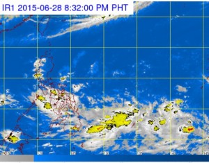
An intertropical convergence zone will bring cloudy skies with moderate to occasionally heavy rain and thunderstorms on Monday, Pagasa said.
The rains may trigger flashfloods and landslides.
In Visayas, light to moderate rains will prevail. In Metro Manila and the rest of Luzon, partly cloudy to cloudy skies with isolated rains will prevail.
Light to moderate winds blowing from the Southwest will prevail over the whole archipelago with slight to moderate seas, Pagasa said.
Disclaimer: The comments uploaded on this site do not necessarily represent or reflect the views of management and owner of Cebudailynews. We reserve the right to exclude comments that we deem to be inconsistent with our editorial standards.