Typhoon Quinta makes 5th landfall in Mindoro, more areas under Signal No. 3
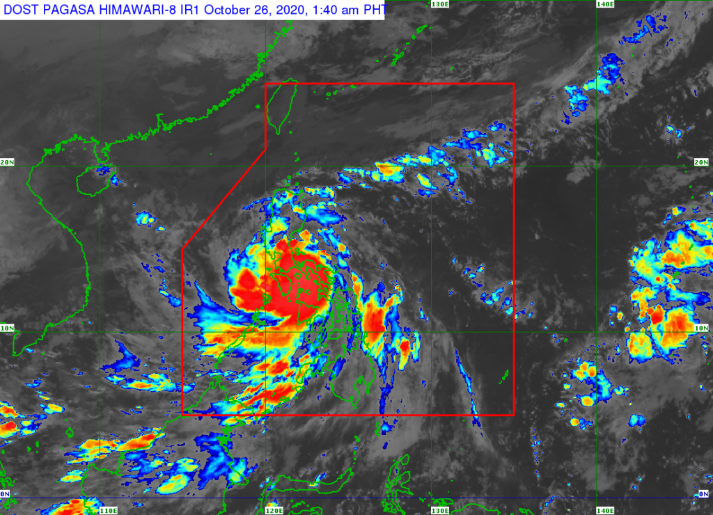
MANILA, Philippines — Tropical Cyclone Wind Signal (TCWS) No. 3 was raised in more areas as Typhoon Quinta made its fifth landfall over Pola, Oriental Mindoro early Monday, October 26, 2020.
The Philippine Atmospheric, Geophysical, and Astronomical Services Administration (Pagasa), in its 5a.m. update, reported that the center of the typhoon is expected to cross the Mindoro provinces en route to the West Philippine Sea Monday morning.
“It will then turn more west-northwestward while maintaining speed towards the western limit of the Philippine area of responsibility (PAR),” Pagasa said.
“Quinta” was last spotted in the vicinity of Socorro, Oriental Mindoro and is moving west at 25 kph.
It has a maximum sustained winds of 125 kph near the center and a gustiness of up to 180 kph.
Pagasa added that Quinta is expected to exit PAR on Tuesday, October 27.
TCWS No. 3 is in effect over the following areas:
- the southern portion of Quezon (Mulanay, San Francisco, Catanauan, General Luna, Macalelon, Pitogo, Unisan, Agdangan, Padre Burgos, Pagbilao, Lucena City, Sariaya, Candelaria, Tiaong, San Antonio, Dolores, Tayabas City)
- the southern portion of Batangas (Lian, Tuy, San Juan, Rosario, Padre Garcia, Lipa City, Cuenca, San Jose, Ibaan, Taysan, Lobo, Batangas City, Mabini, Tingloy, San Pascual, Bauan, Alitagtag, San Luis, Taal, Santa Teresita, Calatagan, Balayan, Calaca, Lemery, Agoncillo, San Nicolas, Mataas Na Kahoy)
- the northern portion of Romblon (Concepcion, Banton, Corcuera, Romblon, San Agustin, Calatrava, San Andres, Odiongan, Santa Maria), Marinduque
- the northern and central portion of Oriental Mindoro (Oriental Mindoro (Mansalay, Roxas, Bongabong, Bansud, Gloria, Pinamalayan, Pola, Socorro, Victoria, Naujan, Calapan City, Baco, San Teodoro, Puerto Galera)
- northern and central portion of Occidental Mindoro (San Jose, Rizal, Calintaan, Sablayan, Santa Cruz, Mamburao, Paluan, Abra de Ilog) including Lubang Island
Residents of these areas, according to Pagasa, could experience winds of from 121-170 kilometers per hour (kph) and intermittent rains within 18 hours.
Meanwhile, TCWS No. 2 is still up over the following areas, where winds of greater than 61 kph and up to 120 kph may be expected in at least 24 hours.
- Metro Manila
- Camarines Norte
- the western portion of Camarines Sur (Siruma, Tinambac, Calabanga, Naga City, Pili, Bula, Balatan, Minalabac, Milaor, Bombon, Magarao, Canaman, Camaligan, Gainza, San Fernando, Pasacao, Pamplona, Cabusao, Libmanan, Sipocot, Lupi, Ragay, Del Gallego)
- Burias Island
- the rest of Quezon including Polillo Islands
- Laguna
- the rest of Batangas
- Cavite
- Rizal
- the southern portion of Bulacan (Norzagaray, Angat, San Rafael, Baliuag, Pulilan, Calumpit, Hagonoy, Paombong, Malolos City, Plaridel, Bustos, San Jose del Monte City, Santa Maria, Pandi, Guiguinto, Balagtas, Bulacan, Bocaue, Meycauayan City, Obando, Marilao)
- the southern portion of Pampanga (Lubao, Sasmuan, Macabebe, Masantol, Minalin, Apalit), Bataan
- the rest of Romblon
- the rest of Oriental Mindoro
- the rest of Occidental Mindoro
- Calamian Islands
- the extreme northern portion of Antique (Caluya)
The following areas are under TCWS No. 1:
- Catanduanes
- the rest of Camarines Sur
- Albay
- the western portion of Sorsogon (Donsol, Pilar, Castilla, Sorsogon City, Casiguran, Juban, Magallanes, Bulan, Irosin)
- the northern portion of mainland Masbate (Uson, Mobo, Masbate City, Baleno, Aroroy, Balud, Mandaon, Milagros) including Ticao Island
- the southern portion of Aurora (Dingalan, San Luis)
- the southern portion of Nueva Ecija (Gabaldon, Laur, Palayan City, General Tinio, Cabanatuan City, Aliaga, Zaragoza, Jaen, San Antonio, Santa Rosa, Peñaranda, Gapan City, San Leonardo, San Isidro, Cabiao)
- the southern portion of Tarlac (La Paz, Tarlac City, San Jose, Concepcion, Capas, Bamban)
- the rest of Bulacan
- the rest of Pampanga
- the central and southern portion of Zambales (Iba, Botolan, Cabangan, San Felipe, San Narciso, San Antonio, San Marcelino, Castillejos, Subic, Olongapo City)
- the northern portion of Palawan (El Nido, Taytay) including Cuyo Islands
Residents from these areas are expected to experience winds of 30-60 kph in at least 36 hours or intermittent rains may be expected within 36 hours.
Pagasa said Quinta is forecast to remain at typhoon category and may “re-intensify” over the West Philippine Sea
The typhoon may “may reach its peak intensity within 24 to 48 hours,” the state weather bureau added.
gsg
Disclaimer: The comments uploaded on this site do not necessarily represent or reflect the views of management and owner of Cebudailynews. We reserve the right to exclude comments that we deem to be inconsistent with our editorial standards.