Pagasa sees no storm threat until yearend; LPA-induced rains expected
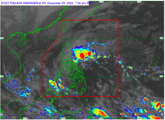
MANILA, Philippines — The low-pressure area (LPA) east of the country is no longer expected to develop into a tropical cyclone but will trigger rains in parts of the country, the Philippine Atmospheric, Geophysical and Astronomical Services Administration (Pagasa) reported on Thursday.
The LPA was last spotted some 100 kilometers southeast of Guiuan, Eastern Samar.
“Base po sa ating analysis, hindi na po ito inaasahan maging bagyo. So wala na tayo inaasahang bagyo pa hanggang sa matapos ang 2022. Gayunpaman itong low pressure area na nakikita natin ngayong araw, posibleng tawirin ang pagitan ng Visayas at Mindanao,” said Pagasa weather specialist Benison Estareja.
(Based on our analysis, the LPA is no longer expected to become a cyclone. So we are not expecting any cyclones until yearend. The LPA may cross the Visayas and Mindanao).
According to Pagasa’s latest weather bulletin, the Mimaropa (Mindoro, Marinduque, Romblon, Palawan), Calabarzon (Cavite, Laguna, Batangas, Rizal, Quezon), Bicol, Eastern and Western Visayas regions will have overcast skies and scattered rains and thunderstorms.
The northeast monsoon or “amihan” will also bring rains to Luzon, including Metro Manila.
Rough seas warning
Pagasa has likewise issued gale warnings over the following areas:
- Eastern Coast Of Quezon (General Nakar, Mauban, Gumaca, Plaridel, Lopez, Calauag, Quezon, Alabat, And Perez) Including the northern and eastern coasts of Polillo Islands (the northern coast of Panukulan, Burdeos, the eastern coast of Polillo, Patnanungan, and Jomalig)
- Camarines Norte
- Northern and eastern coasts of Camarines Sur
- Catanduanes
- Eastern coast of Albay
- Eastern coast of Sorsogon
- Batanes
- Cagayan including Babuyan Islands
- Isabela
- Aurora
- Ilocos Norte
- Ilocos Sur
- La Union
- Pangasinan
- Northern Samar
- Eastern Samar
- Eastern coast of Southern Leyte
- Dinagat Islands
- Surigao Del Norte including Siargao and Bucas Grande Islands
Fishermen and crew members of small vessels are advised against setting sail due to rough sea conditions.
Forecast temperature range in key cities /areas on Thursday
- Metro Manila: 23 to 29 degrees Celsius
- Baguio City: 13 to 22 degrees Celsius
- Laoag City: 19 to 30 degrees Celsius
- Tuguegarao: 20 to 25 degrees Celsius
- Legazpi City: 23 to 27 degrees Celsius
- Puerto Princesa City: 25 to 29 degrees Celsius
- Tagaytay: 19 to 27 degrees Celsius
- Kalayaan Islands: 25 to 29 degrees Celsius
- Iloilo City: 25 to 28 degrees Celsius
- Cebu: 24 to 28 degrees Celsius
- Tacloban City: 24 to 27 degrees Celsius
- Cagayan De Oro City: 23 to 27 degrees Celsius
- Zamboanga City: 24 to 32 degrees Celsius
- Davao City: 24 to 32 degrees Celsius
gsg
Click here for more weather related news.
Disclaimer: The comments uploaded on this site do not necessarily represent or reflect the views of management and owner of Cebudailynews. We reserve the right to exclude comments that we deem to be inconsistent with our editorial standards.