Pagasa: Typhoon Chedeng to enhance ‘habagat’, rain expected in parts of Luzon

| Pagasa
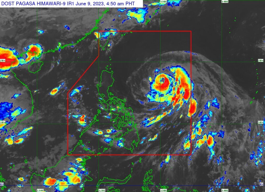
MANILA, Philippines — Typhoon Chedeng (international name: Guchol) is forecast to reach peak intensity on Friday and trigger rain in parts of Luzon by enhancing the southwest monsoon or “habagat”, state meteorologists said.
“Chedeng is likely reaching its peak intensity within the next 24 to 36 hours due to marginally favorable environmental conditions,” the Philippine Atmospheric, Geophysical and Astronomical Services Administration (Pagasa) said in its 5:00 am update.
“The southwest monsoon (habagat) may be enhanced by Chedeng and bring occasional rains over some portions of southwestern Luzon in the next 3 days.” Pagasa addded.
READ: Typhoon Chedeng – live updates
Pagasa said the center of Chedeng was spotted Friday morning some 875 kilometers east of Central Luzon, packing maximum sustained winds of 130 kilometers per hour (kph) near the center and gustiness of up to 160 kph.
By weekend, Pagasa said the typhoon may start to weaken, although it is seen to remain as a typhoon within the forecast period.
Chedeng will also remain distant from the country’s landmass, making it unlikely to cause direct heavy rainfall in the next three to five days, according to the state weather bureau.
Pagasa said the typhoon, which is moving northwest at 10 kph, will slow down by Friday before gradually accelerating over the weekend.
“It is forecast to begin its recurve by slowing down and turning towards the north today, then gradually accelerate north northeastward tomorrow. On Sunday, Chedeng will be accelerating further while moving northeastward over the sea south of Japan,” said Pagasa.
It may exit the Philippine area of responsibility by Monday morning, said Pagasa.
Disclaimer: The comments uploaded on this site do not necessarily represent or reflect the views of management and owner of Cebudailynews. We reserve the right to exclude comments that we deem to be inconsistent with our editorial standards.
