Pagasa: Storm Enteng may intensify when it crosses WPS
Storm Signal No. 2 in 6 areas in Luzon, says state weather bureau

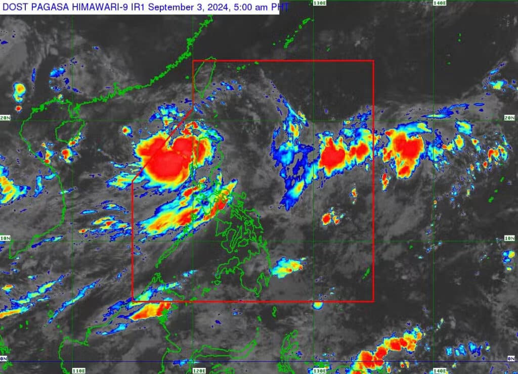
MANILA, Philippines — The Philippine Atmospheric, Geophysical, and Astronomical Services Administration (Pagasa) reported on Tuesday morning that Tropical Storm Enteng (international name: Yagi) may further intensify once it crosses the West Philippine Sea.
Meanwhile, over several parts of Luzon, Tropical cyclone Wind Signals (TCWS) are up.
Signal No. 2 is up over the following areas:
- Ilocos Norte
- Northern part of Ilocos Sur (Sinait, Cabugao, San Juan, Magsingal, Santo Domingo, San Ildefonso, San Vicente, Santa Catalina, City of Vigan, Bantay, Santa, Caoayan)
- Apayao
- Abra
- Kalinga
- Western portion of Mainland Cagayan (Piat, Santo Niño, Camalaniugan, Tuao, Pamplona, Alcala, Amulung, Buguey, Solana, Rizal, Claveria, Iguig, Lasam, Aparri, Ballesteros, Abulug, Allacapan, Sanchez-Mira, Santa Praxedes) including Babuyan Islands (Calayan Is., Dalupri Is., Fuga Is.)
READ MORE:
LIVE UPDATES: Tropical Storm Enteng
Pagasa: Tropical Storm Enteng moves over Kalinga as it slows down
EXPLAINER: What do color-coded rainfall warnings mean?
Signal No. 1 is up over the following areas:
- The rest of Ilocos Sur
- Northern part of La Union (Luna, Santol, San Juan, Bagulin, Bangar, San Gabriel, Bacnotan, Sudipen, Balaoan)
- Mountain Province
- Ifugao
- Northern portion of Benguet (Mankayan, Kapangan, Atok, Kabayan, Kibungan, Bakun, Buguias, Tublay)
- Batanes
- The rest of Mainland Cagayan
- The rest of Babuyan Islands
- Isabela
- Northern portion of Nueva Vizcaya (Bayombong, Ambaguio, Bagabag, Villaverde, Diadi, Quezon, Solano)
- Northern portion of Quirino (Aglipay, Saguday, Diffun, Cabarroguis)
READ MORE: Palace suspends classes, gov’t work in Metro Manila, Calabarzon on Sept. 3
Tracking Enteng
In its 5:00 a.m. weather forecast, Pagasa said that the center of the tropical storm was tracked over the waters of Paoay, Ilocos Norte with a maximum sustained wind speed pof 75 kilometers per hour (kph) near the center and gustiness of up to 125 kph whule moving northwest at 25 kph.
“Kapansin-pansin po ‘yong bahagyang paghina ng bagyong Enteng dahil dumaan ito sa may areas po ng Cagayan Valley at Cordillera Region, ‘yong mga bulubundukin pong lugar doon na bahagyang nagpahina. Ngunit pagdating po dito sa West Philippine Sea mamayang umaga, ay posible po muling lumakas itong si bagyong Enteng,” said Pagasa weather specialist Benison Estareja.
(It is noticeable that Tropical Storm Enteng slightly weakened when it passed through Cagayan Valley and the Cordillera Region, the mountainous areas, where it slightly weakened. But once it reaches the West Philippine Sea later in the morning, Tropical Storm Enteng may intensify again.)
“Enteng is forecast to continue moving generally northwestward over the next 24 hours and is expected to turn westward over the West Philippine Sea starting tomorrow (4 September) until it [reaches] Hainan, China on Saturday (7 September),” the state weather bureau said.
It is forecast to exit the Philippine area of responsibility by Wednesday morning and is expected to intensify into a severe tropical storm by Tuesday afternoon (at the earliest) or Tuesday evening, and into a typhoon by Thursday.
‘Habagat’ and gale warnings
Meanwhile, the enhanced southwest monsoon or “habagat” will trigger moderate to intense rains in other parts Luzon, particularly the western sections over the next three days.
Gale warnings are up over the seaboards of Northern Luzon and eastern part of Central and Southern Luzon.
Pagasan warned that sea travel is risky for small vessels.
Disclaimer: The comments uploaded on this site do not necessarily represent or reflect the views of management and owner of Cebudailynews. We reserve the right to exclude comments that we deem to be inconsistent with our editorial standards.
