LPA spotted east of Visayas, may become tropical depression

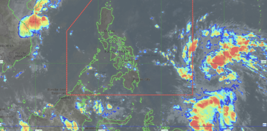
Himawari satellite image as of November 3, 2024. | Screenshot from Pagasa Website
CEBU CITY, Philippines – The state weather bureau is currently monitoring a low-pressure area (LPA) that may likely become a tropical depression within this week.
The LPA was spotted 1,495 kilometers east of Eastern Visayas as of 10 a.m. on Sunday, November 3.
According to Pagasa, the LPA has a high chance of developing into a tropical depression within the next 24 hours.
If it does, it will be given the name ‘Marce’ upon entering the Philippine Area of Responsibility (PAR).
READ MORE:
New LPA outside PAR unlikely to affect PH – Pagasa-Mactan
Weather update: Another LPA forms outside PAR
LPA outside PAR may become tropical depression Friday – Pagasa
Pagasa advised the public to regularly monitor weather updates, particularly on developments regarding the LPA.
In the meantime, Pagasa’s Mactan station forecasted that Visayas – Palawan including Kalayaan islands and Occidental Mindoro – will have cloudy skies beginning Sunday.
This means that the region, where Cebu is located, will experience partly cloudy to cloudy skies with isolated rainshowers or thunderstorms due to localized thunderstorms or easterlies.
Metro Cebu will also have temperatures ranging between 26 degree to 32 degree Celsius in the next five days.
Disclaimer: The comments uploaded on this site do not necessarily represent or reflect the views of management and owner of Cebudailynews. We reserve the right to exclude comments that we deem to be inconsistent with our editorial standards.
