Ulysses weakens, Signal No. 3 still up over Metro Manila, 8 other areas
MANILA, Philippines — Typhoon Ulysses weakened on Thursday morning, November 12, 2020, while leaving the Luzon landmass, the Philippine Atmospheric, Geophysical, and Astronomical Services Administration (Pagasa) said.
Tropical Cyclone Wind Signal No. 3, however, is still up over parts of Luzon including Metro Manila.
Pagasa said that as of 7a.m., the eye of weather disturbance was last spotted from Subic and Benguet Doppler radar stations in the vicinity of Cabangan, Zambales.
Ulysses was moving west-northwest at 30 kilometers per hour (kph) with maximum sustained winds of 130 kph near the center and gustiness of up to 215 kph.
The typhoon’s maximum sustained winds at dawn was measured at 155 ph with gustiness of up to 255 kph.
Ulysses is expected to emerge over the western seaboard of Zambales within the next hour.
Pagasa warned that heavy to intense and at times torrential rains are expected in Metro Manila, Calabarzon and Central Luzon until Thursday afternoon.
Pagasa added that moderate to heavy and at times intense rains may prevail in the Cordillera Administrative Region, mainland Cagayan Valley, Babuyan Islands, Pangasinan, Marinduque, and the northern portion of Mindoro Provinces including Lubang Island. Light to moderate with at times heavy rains may hit the Visayas and rest of Luzon.”
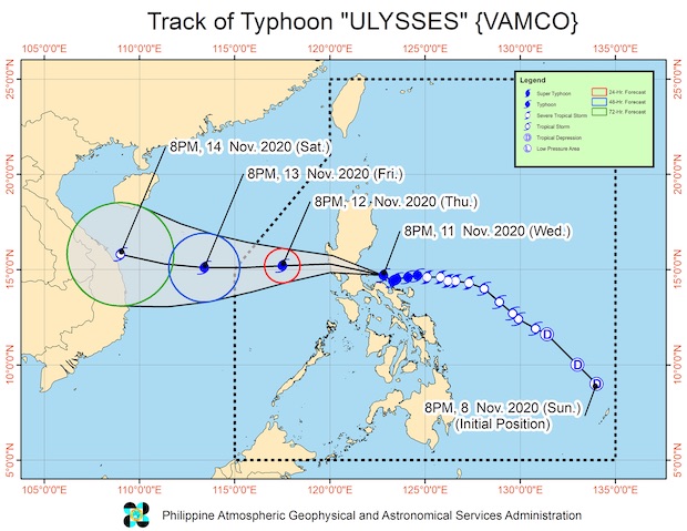
“Slight intensification is likely as the typhoon moves over the West Philippine Sea away from the landmass,” said Pagasa.
The typhoon is expected to leave the Philippine area of responsibility on Friday morning or afternoon.
Pagasa also warned of strong winds and destructive force winds for areas under Tropical Cyclone Wind Signal (TCWS) #3.
TROPICAL CYCLONE WIND SIGNAL (TCWS) #3
(121-170 km/h winds prevailing or expected in 18 hours)
LUZON:
The northern portion of Cavite (Naic, Tanza, Ternate, Maragondon, Rosario, Noveleta, Cavite City, Kawit, Bacoor, Imus, General Trias, Trece Martires City, Dasmariñas), Metro Manila, the western portion of Bulacan (San Miguel, San Ildefonso, San Rafael, Angat, Santa Maria, Marilao, Meycauayan City, Obando, Bulacan, Bocaue, Pandi, Bustos, Baliuag, Plaridel, Balagtas, Guiguinto, Malolos City, Paombong, Hagonoy, Calumpit, Pulilan), the western portion of Nueva Ecija (Gapan City, Peñaranda, Santa Rosa, Cabanatuan City, General Mamerto Natividad, Llanera, San Jose City, Lupao, Cabiao, San Isidro, San Leonardo, Jaen, San Antonio, Zaragoza, Aliaga, Talavera, Licab, Quezon, Santo Domingo, Guimba, Muñoz City, Talugtug, Cuyapo, Nampicuan), Pampanga, Tarlac, Bataan, Zambales, and Pangasinan
TCWS #2
(61-120 km/h winds prevailing or expected in 24 hours)
LUZON: The central and southern portions of Isabela (Mallig, Quirino, Ilagan, Roxas, Burgos, Gamu, Palanan, San Mariano, Dinapigue, San Guillermo, Benito Soliven, Naguilian, Reina Mercedes, Luna, San Manuel, Aurora, Cabatuan, Cauayan City, San Mateo, Alicia, Angadanan, Echague, Jones, San Agustin, San Isidro, Ramon, Santiago City, Cordon), Quirino, Nueva Vizcaya, Mountain Province, Ifugao, Benguet, the southern portion of Ilocos Sur (Cervantes, Quirino, San Emilio, Lidlidda, Santiago, Banayoyo, Candon City, Galimuyod, Gregorio Del Pilar, Salcedo, Santa Lucia, Santa Cruz, Sigay, Suyo, Tagudin, Alilem, Sugpon), La Union, Aurora, the rest of Nueva Ecija, the rest of Bulacan, the northern and central portion of Quezon (San Antonio, Tiaong, Dolores, Candelaria, Sariaya, Lucban, Tayabas City, Lucena City, Pagbilao, Perez, Alabat, Atimonan, Padre Burgos, Agdangan, Plaridel, Mauban, Sampaloc, Real, General Nakar, Infanta) including Polillo Islands, Rizal, Laguna, the rest of Cavite, Batangas, the northern portion of Oriental Mindoro (Puerto Galera, San Teodoro, Baco, Calapan City), and the northern portion of Occidental Mindoro (Paluan, Abra de Ilog) including Lubang Island
TCWS #1
(30-60 km/h winds prevailing or expected in 36 hours)
LUZON:
(30-60 km/h winds prevailing or expected in 36 hours) The rest of Isabela, Kalinga, Abra, the rest of Ilocos Sur, the rest of Occidental Mindoro, the rest of Oriental Mindoro, Marinduque, the northern portion of Romblon (Corcuera, Banton, Concepcion), the rest of Quezon, Camarines Norte, and the western portion of Camarines Sur (Siruma, Tinambac, Calabanga, Bombon, Magarao, Canaman, Camaligan, Gainza, Pamplona, Pasacao, Libmanan, Cabusao, Sipocot, Lupi, Ragay, Del Gallego)
Disclaimer: The comments uploaded on this site do not necessarily represent or reflect the views of management and owner of Cebudailynews. We reserve the right to exclude comments that we deem to be inconsistent with our editorial standards.