‘Bising’ maintains strength, to bring rains over Eastern Visayas, Bicol region
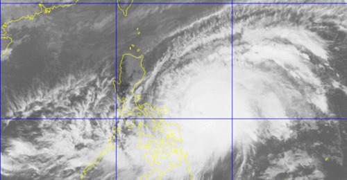
Satellite image of Typhoon Bising from Pagasa
MANILA, Philippines — Typhoon Bising will bring moderate to heavy rains, “with at times intense rains” over Eastern Visayas and Bicol Region on Sunday as it maintains strength, the state weather bureau said.
In its morning update, the Philippine Atmospheric, Geophysical and Astronomical Services Administration (Pagasa) said Typhoon Bising was last spotted 400 kilometers (km) east of Catarman, Northern Samar or 470 km East of Juban, Sorsogon.
The typhoon is moving northwestward at 15 kilometers per hour (kph) and has maximum sustained winds of 215 kph near the center and gustiness of up to 265 kph.
Tropical Cyclone Wind Signal (TCWS) No. 2 remains hoisted over Catanduanes, Northern Samar, Eastern Samar, and Samar.
“Based on the current forecast scenario, TCWS #2 remains the highest level of wind signal that will be hoisted due to this typhoon,” Pagasa said.
“However, in the event of a further eastward or westward shift in the current track forecast, the highest level of wind signal that will be hoisted for this typhoon may be lower or higher than the current scenario suggests,” it added.
Meanwhile, TCWS No. 1 is raised over the following areas:
Luzon
The eastern portion of Camarines Norte (San Lorenzo Ruiz, San Vicente, Vinzons, Talisay, Daet, Mercedes, Basud)
Camarines Sur
Albay, Sorsogon
Masbate including Burias and Ticao Islands
Visayas
Biliran
Leyte
Southern Leyte
Northern portion of Cebu (Tabogon, Borbon, San Remigio, Bogo City, Medellin, Daanbantayan) including Bantayan and Camotes Islands
Mindanao
Dinagat Islands
Surigao del Norte including Siargao and Bucas Grande Islands
Northern portion of Surigao del Sur (Cagwait, Tago, Bayabas, Tandag City, Lanuza, Cortes, Carmen, Madrid, Cantilan, Carrascal)
According to the state weather bureau, the typhoon will bring very rough (4.0 to 12.0 m) to very high in the northern and eastern seaboard of Eastern Visayas while the eastern seaboard of Luzon will have rough to very high seas (2.5 to 12.0 m).
For the eastern seaboard of Caraga, Pagasa said rough to very rough seas (3.0 to 5.0 m) can be expected.
“Sea travel is risky for all types of seacrafts over these waters,” the state weather bureau said.
Meanwhile, rough to very rough seas (2.5 to 5.0 m) over the northern and western seaboards of Northern Luzon and rough seas (2.5 to 3.5 m) over the eastern seaboard of Davao Region are expected due to the typhoon, according to Pagasa.
“Sea travel is risky for small seacrafts over these waters. Mariners without the proper experience should immediately seek safe harbor,” it added.
The western seaboard of Central Luzon the remaining seaboards of localities where wind signals are in affect will have moderate to rough seas (1.5 m to 3.0 m), the state weather bureau further said.
“Mariners of small seacrafts are advised not to venture out over these waters. Inexperienced mariners of these vessels should avoid navigating in these conditions,” Pagasa added.
According to Pagasa, Typhoon Bising will continue to move northwestward over the country’s waters east of Bicol Region and “is likely to slow down considerably and begin turning more northward” on Sunday night or early Monday morning.
Disclaimer: The comments uploaded on this site do not necessarily represent or reflect the views of management and owner of Cebudailynews. We reserve the right to exclude comments that we deem to be inconsistent with our editorial standards.