‘Amihan’, trough of LPA to bring rains in parts of PH — Pagasa
MANILA — The northeast monsoon or “amihan” and the trough of a low pressure area’s (LPA) will bring rain showers to over parts of the country on Tuesday, according to the Philippine Atmospheric, Geophysical, and Astronomical Services Administration (Pagasa).
The effects of these two weather systems can cause cloudy skies and more chances of rain especially in the Cagayan Valley and Bicol Region among others.
That is according to the weather bureau.
READ: Pagasa: Mostly cloudy to cloudy skies in Metro Cebu until Feb. 1
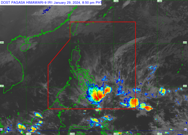
Amihan, trough of LPA
“Sa ating magiging lagay ng panahon bukas dahil sa epekto ng northeast monsoon, magiging maulap ang kalangitan na may tiyansa ng mahihinang pagulan sa Cagayan Valley, Cordillera, Aurora, Quezon, at Bicol Region,” said Pagasa weather specialist Aldczar Aurelio.
(Due to the effects of the northeast monsoon, the skies are expected to be mostly cloudy with a chance of light rain in Cagayan Valley, Cordillera, Aurora, Quezon, and the Bicol region.)
Meanwhile, the trough of an LPA, which is currently located 1,000 kilometers east northeast of Southeastern Mindanao and outside the Philippine area of responsibility, will also trigger rain showers to parts of the Visayas and Mindanao.
“Dahil po sa trough ng LPA bukas po magiging maulan ang panahon sa Eastern Visayas, kasama na rin po ang Central Visayas, Davao Region at Caraga,” said Aurelio.
(Due to the trough of an LPA, tomorrow’s weather is expected to be rainy in Eastern Visayas, Central Visayas, the Davao and Caraga regions.)
READ: Pagasa: No tropical cyclones expected until end of January
LPA won’t enter PAR
However, the said LPA would not be expected to enter PAR or intensify into a typhoon.
The remaining parts of the country, on the other hand, will have fair weather conditions with partly cloudy to overcast skies expected, and rain due to isolated thunderstorms.
Forecast temperature range in key cities/areas on Tuesday
- Metro Manila: 22 to 30 degrees Celsius
- Baguio City: 12 to 22 degrees Celsius
- Laoag City: 18 to 30 degrees Celsius
- Tuguegarao: 20 to 27 degrees Celsius
- Legazpi City: 24 to 29 degrees Celsius
- Puerto Princesa City: 25 to 31 degrees Celsius
- Tagaytay: 18 to 28 degrees Celsius
- Kalayaan Islands: 25 to 31 degrees Celsius
- Iloilo City: 24 to 29 degrees Celsius
- Cebu: 25 to 29 degrees Celsius
- Tacloban City: 23 to 30 degrees Celsius
- Cagayan De Oro City: 24 to 29 degrees Celsius
- Zamboanga City: 23 to 33 degrees Celsius
- Davao City: 24 to 29 degrees Celsius
ALSO READ: Have you felt it? Chilly weather expected in Cebu as ‘amihan’ intensifies – Pagasa
Gale warnings
A gale warning is in effect over the northern and eastern seaboards of Luzon, specifically, Batanes the northern coast of Cagayan including Babuyan islands the northern coast of Ilocos Norte, the northern coast of Camarines Norte, the eastern coast of Albay and the northern and eastern coasts of Sorsogon.
A gale warning was likewise raised over the eastern seaboards of Visayas and Mindanao, specifically, Northern Samar, Eastern Samar, Samar, Biliran, Leyte, Southern Leyte, Dinagat Islands, Surigao del Norte including Siargao and Bucas Grande Islands, Surigao del Sur and the eastern coast of Davao Oriental.
Wave height of up to 4.5 meters should be expected in these areas.
Disclaimer: The comments uploaded on this site do not necessarily represent or reflect the views of management and owner of Cebudailynews. We reserve the right to exclude comments that we deem to be inconsistent with our editorial standards.