600,000 people displaced by ‘habagat’, ‘Carina’ intensifies slightly
MANILA, Philippines — More than 600,000 people has so far been affected by the southwest monsoon locally called “habagat,” according to the the national disaster office in a report.
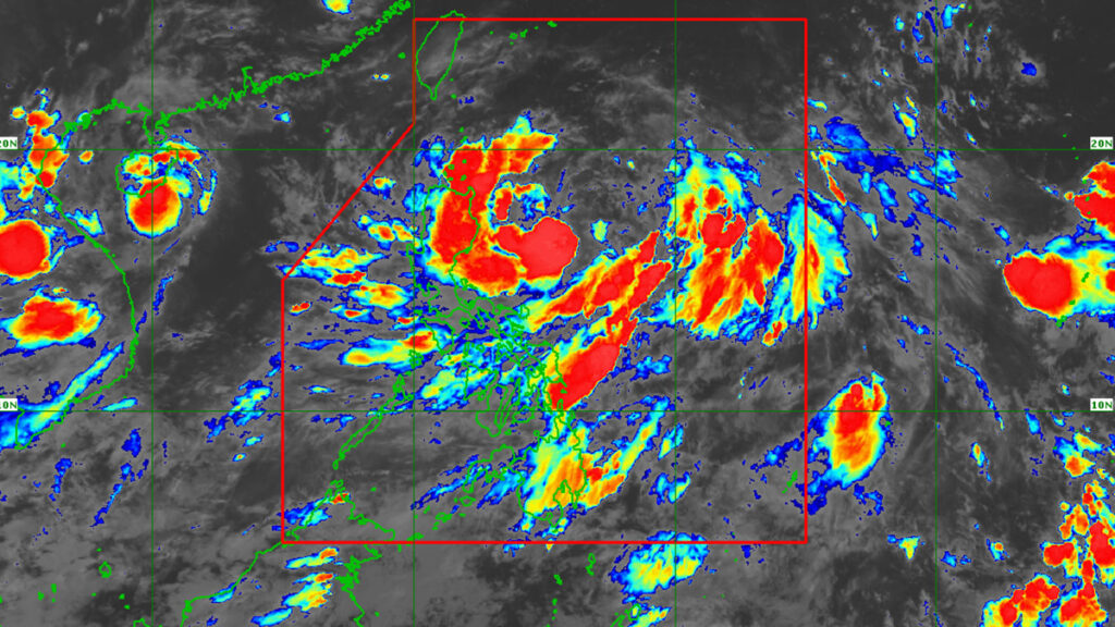
This as Tropical Storm “Carina” (international name: Gaemi) intensified slightly on Sunday.
No wind signal in any part of the country has been raised by the Philippine Atmospheric, Geophysical and Astronomical Services Administration (Pagasa) as the storm was still 490 kilometers east of Casiguran, Aurora, on Sunday.
“Carina is forecast to steadily intensify over the next four days due to a favorable environment,” Pagasa reported.
READ MORE:
2 cyclones to boost monsoon strength, says Pagasa
Pagasa: Tropical Depression Butchoy exits PAR
LPA floods parts of northern Cebu, 1 hurt in landslide
“It is forecast to become a severe tropical storm by tomorrow and reach typhoon category on Tuesday. Rapid intensification within the forecast period is possible,” the weather bureau added.
Also on Sunday, the the National Disaster Risk Reduction and Management Council (NDRRMC) reported that people displaced by monsoon rains have reached 384,966—22,388 went to evacuation centers while 362,578 took shelter elsewhere.
In its latest report, the NDRRMC said 636,110 individuals or 131,388 families residing in 521 barangays nationwide were impacted by the habagat.
The number of flooded areas has reached 295.
Floods were reported in the regions of Mimaropa, Central Visayas, Zamboanga Peninsula, Northern Mindanao, Davao and Bangsamoro.
The habagat has also caused at least P8 million in damage to crops, the NDRRMC reported.
The weather condition has also adversely affected at least 264 farmers and fisherfolk.
According to state weather bureau’s report, habagat has been bringing moderate to heavy and heavy to intense rain over the western sections of southern Luzon, Visayas and Mindanao since last week.
Carina itself has not hit land anywhere and neither did Tropical Storm “Butchoy” (international name: 04W), which left the Philippine Area of Responsibility (PAR) on Saturday morning.
But Carina is expected to further intensify in the Philippines Sea as it continues its west-northwesterly tack, off the country’ eastern seaboard, until it intensifies into a typhoon on Tuesday, before exiting the PAR on Wednesday.
Disclaimer: The comments uploaded on this site do not necessarily represent or reflect the views of management and owner of Cebudailynews. We reserve the right to exclude comments that we deem to be inconsistent with our editorial standards.

